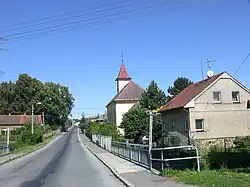
Kařez
Kařez | |
|---|---|
 Church of Saint John of Nepomuk | |
 Flag 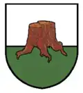 Coat of arms | |
 Kařez Location in the Czech Republic | |
| Coordinates: 49°49′28″N 13°46′54″E / 49.82444°N 13.78167°E | |
| Country | |
| Region | Plzeň |
| District | Rokycany |
| First mentioned | 1281 |
| Area | |
• Total | 5.87 km2 (2.27 sq mi) |
| Elevation | 452 m (1,483 ft) |
| Population (2025-01-01)[1] | |
• Total | 733 |
| • Density | 120/km2 (320/sq mi) |
| Time zone | UTC+1 (CET) |
| • Summer (DST) | UTC+2 (CEST) |
| Postal code | 338 08 |
| Website | www |
Kařez is a municipality and village in Rokycany District in the Plzeň Region of the Czech Republic. It has about 700 inhabitants.
Kařez lies approximately 17 kilometres (11 mi) north-east of Rokycany, 31 km (19 mi) east of Plzeň, and 55 km (34 mi) south-west of Prague.
Demographics
| Year | Pop. | ±% |
|---|---|---|
| 1869 | 313 | — |
| 1880 | 510 | +62.9% |
| 1890 | 584 | +14.5% |
| 1900 | 521 | −10.8% |
| 1910 | 512 | −1.7% |
| 1921 | 780 | +52.3% |
| 1930 | 720 | −7.7% |
| 1950 | 642 | −10.8% |
| 1961 | 694 | +8.1% |
| 1970 | 627 | −9.7% |
| 1980 | 618 | −1.4% |
| 1991 | 544 | −12.0% |
| 2001 | 541 | −0.6% |
| 2011 | 591 | +9.2% |
| 2021 | 708 | +19.8% |
| Source: Censuses[2][3] | ||
Transport
Kařez is located on the railway lines Prague–Klatovy and Plzeň–Beroun.[4]
References
- ^ "Population of Municipalities – 1 January 2025". Czech Statistical Office. 2025-05-16.
- ^ "Historický lexikon obcí České republiky 1869–2011" (in Czech). Czech Statistical Office. 2015-12-21.
- ^ "Population Census 2021: Population by sex". Public Database. Czech Statistical Office. 2021-03-27.
- ^ "Detail stanice Kařez" (in Czech). České dráhy. Retrieved 2023-08-14.
External links
Wikimedia Commons has media related to Kařez.