Sirá
Sirá | |
|---|---|
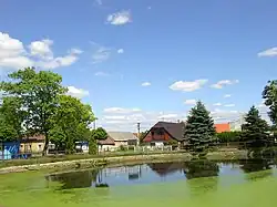 Centre of Sirá | |
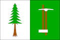 Flag 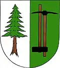 Coat of arms | |
 Sirá Location in the Czech Republic | |
| Coordinates: 49°49′18″N 13°44′19″E / 49.82167°N 13.73861°E | |
| Country | |
| Region | Plzeň |
| District | Rokycany |
| First mentioned | 1462 |
| Area | |
• Total | 6.43 km2 (2.48 sq mi) |
| Elevation | 497 m (1,631 ft) |
| Population (2025-01-01)[1] | |
• Total | 158 |
| • Density | 25/km2 (64/sq mi) |
| Time zone | UTC+1 (CET) |
| • Summer (DST) | UTC+2 (CEST) |
| Postal code | 337 01 |
| Website | www |
Sirá is a municipality and village in Rokycany District in the Plzeň Region of the Czech Republic. It has about 200 inhabitants.
Sirá lies approximately 14 kilometres (9 mi) north-east of Rokycany, 28 km (17 mi) east of Plzeň, and 58 km (36 mi) south-west of Prague.
Demographics
| Year | Pop. | ±% |
|---|---|---|
| 1869 | 264 | — |
| 1880 | 257 | −2.7% |
| 1890 | 226 | −12.1% |
| 1900 | 207 | −8.4% |
| 1910 | 228 | +10.1% |
| 1921 | 221 | −3.1% |
| 1930 | 231 | +4.5% |
| 1950 | 196 | −15.2% |
| 1961 | 175 | −10.7% |
| 1970 | 157 | −10.3% |
| 1980 | 121 | −22.9% |
| 1991 | 96 | −20.7% |
| 2001 | 91 | −5.2% |
| 2011 | 120 | +31.9% |
| 2021 | 149 | +24.2% |
| Source: Censuses[2][3] | ||
References
- ^ "Population of Municipalities – 1 January 2025". Czech Statistical Office. 2025-05-16.
- ^ "Historický lexikon obcí České republiky 1869–2011" (in Czech). Czech Statistical Office. 2015-12-21.
- ^ "Population Census 2021: Population by sex". Public Database. Czech Statistical Office. 2021-03-27.
External links
Wikimedia Commons has media related to Sirá.