Kadolec
Kadolec | |
|---|---|
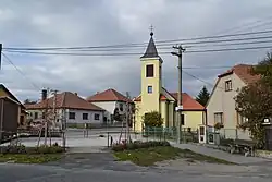 Centre of Kadolec | |
 Flag  Coat of arms | |
 Kadolec Location in the Czech Republic | |
| Coordinates: 49°22′29″N 16°8′30″E / 49.37472°N 16.14167°E | |
| Country | |
| Region | Vysočina |
| District | Žďár nad Sázavou |
| First mentioned | 1364 |
| Area | |
• Total | 6.08 km2 (2.35 sq mi) |
| Elevation | 595 m (1,952 ft) |
| Population (2025-01-01)[1] | |
• Total | 163 |
| • Density | 27/km2 (69/sq mi) |
| Time zone | UTC+1 (CET) |
| • Summer (DST) | UTC+2 (CEST) |
| Postal code | 594 51 |
| Website | www |
Kadolec is a municipality and village in Žďár nad Sázavou District in the Vysočina Region of the Czech Republic. It has about 200 inhabitants.
Kadolec lies approximately 26 kilometres (16 mi) south-east of Žďár nad Sázavou, 40 km (25 mi) east of Jihlava, and 147 km (91 mi) south-east of Prague.
Demographics
| Year | Pop. | ±% |
|---|---|---|
| 1869 | 360 | — |
| 1880 | 371 | +3.1% |
| 1890 | 349 | −5.9% |
| 1900 | 312 | −10.6% |
| 1910 | 300 | −3.8% |
| 1921 | 274 | −8.7% |
| 1930 | 273 | −0.4% |
| 1950 | 240 | −12.1% |
| 1961 | 220 | −8.3% |
| 1970 | 227 | +3.2% |
| 1980 | 205 | −9.7% |
| 1991 | 164 | −20.0% |
| 2001 | 165 | +0.6% |
| 2011 | 154 | −6.7% |
| 2021 | 172 | +11.7% |
| Source: Censuses[2][3] | ||
References
- ^ "Population of Municipalities – 1 January 2025". Czech Statistical Office. 2025-05-16.
- ^ "Historický lexikon obcí České republiky 1869–2011" (in Czech). Czech Statistical Office. 2015-12-21.
- ^ "Population Census 2021: Population by sex". Public Database. Czech Statistical Office. 2021-03-27.
External links
Wikimedia Commons has media related to Kadolec.