Ořechov (Žďár nad Sázavou District)
Ořechov | |
|---|---|
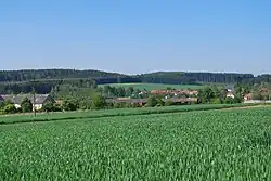 General view | |
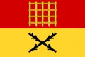 Flag 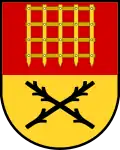 Coat of arms | |
 Ořechov Location in the Czech Republic | |
| Coordinates: 49°21′2″N 16°8′20″E / 49.35056°N 16.13889°E | |
| Country | |
| Region | Vysočina |
| District | Žďár nad Sázavou |
| First mentioned | 1366 |
| Area | |
• Total | 5.35 km2 (2.07 sq mi) |
| Elevation | 549 m (1,801 ft) |
| Population (2025-01-01)[1] | |
• Total | 350 |
| • Density | 65/km2 (170/sq mi) |
| Time zone | UTC+1 (CET) |
| • Summer (DST) | UTC+2 (CEST) |
| Postal code | 594 52 |
| Website | www |
Ořechov is a municipality and village in Žďár nad Sázavou District in the Vysočina Region of the Czech Republic. It has about 400 inhabitants.
Ořechov lies approximately 28 kilometres (17 mi) south-east of Žďár nad Sázavou, 40 km (25 mi) east of Jihlava, and 148 km (92 mi) south-east of Prague.
Administrative division
Ořechov consists of two municipal parts (in brackets population according to the 2021 census):[2]
- Ořechov (224)
- Ronov (87)
Demographics
| Year | Pop. | ±% |
|---|---|---|
| 1869 | 474 | — |
| 1880 | 505 | +6.5% |
| 1890 | 428 | −15.2% |
| 1900 | 463 | +8.2% |
| 1910 | 449 | −3.0% |
| 1921 | 458 | +2.0% |
| 1930 | 426 | −7.0% |
| 1950 | 424 | −0.5% |
| 1961 | 427 | +0.7% |
| 1970 | 398 | −6.8% |
| 1980 | 346 | −13.1% |
| 1991 | 321 | −7.2% |
| 2001 | 310 | −3.4% |
| 2011 | 309 | −0.3% |
| 2021 | 311 | +0.6% |
| Source: Censuses[3][4] | ||
References
- ^ "Population of Municipalities – 1 January 2025". Czech Statistical Office. 2025-05-16.
- ^ "Public Census 2021 – basic data". Public Database (in Czech). Czech Statistical Office. 2022.
- ^ "Historický lexikon obcí České republiky 1869–2011" (in Czech). Czech Statistical Office. 2015-12-21.
- ^ "Population Census 2021: Population by sex". Public Database. Czech Statistical Office. 2021-03-27.
External links
Wikimedia Commons has media related to Ořechov (Žďár nad Sázavou District).