Kněževes (Prague-West District)
Kněževes | |
|---|---|
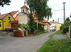 Belfry and a farm | |
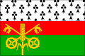 Flag 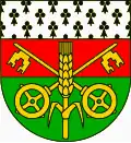 Coat of arms | |
 Kněževes Location in the Czech Republic | |
| Coordinates: 50°7′13″N 14°15′38″E / 50.12028°N 14.26056°E | |
| Country | |
| Region | Central Bohemian |
| District | Prague-West |
| First mentioned | 1088 |
| Area | |
• Total | 2.55 km2 (0.98 sq mi) |
| Elevation | 334 m (1,096 ft) |
| Population (2025-01-01)[1] | |
• Total | 649 |
| • Density | 250/km2 (660/sq mi) |
| Time zone | UTC+1 (CET) |
| • Summer (DST) | UTC+2 (CEST) |
| Postal code | 252 68 |
| Website | www |
Kněževes is a municipality and village in Prague-West District in the Central Bohemian Region of the Czech Republic. It has about 600 inhabitants.
Demographics
| Year | Pop. | ±% |
|---|---|---|
| 1869 | 430 | — |
| 1880 | 423 | −1.6% |
| 1890 | 446 | +5.4% |
| 1900 | 450 | +0.9% |
| 1910 | 526 | +16.9% |
| 1921 | 508 | −3.4% |
| 1930 | 613 | +20.7% |
| 1950 | 582 | −5.1% |
| 1961 | 577 | −0.9% |
| 1970 | 561 | −2.8% |
| 1980 | 604 | +7.7% |
| 1991 | 550 | −8.9% |
| 2001 | 524 | −4.7% |
| 2011 | 595 | +13.5% |
| 2021 | 651 | +9.4% |
| Source: Censuses[2][3] | ||
References
- ^ "Population of Municipalities – 1 January 2025". Czech Statistical Office. 2025-05-16.
- ^ "Historický lexikon obcí České republiky 1869–2011" (in Czech). Czech Statistical Office. 2015-12-21.
- ^ "Population Census 2021: Population by sex". Public Database. Czech Statistical Office. 2021-03-27.
External links
Wikimedia Commons has media related to Kněževes (Prague-West District).