Kostěnice
Kostěnice | |
|---|---|
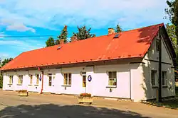 Municipal office | |
 Flag  Coat of arms | |
 Kostěnice Location in the Czech Republic | |
| Coordinates: 50°0′35″N 15°54′13″E / 50.00972°N 15.90361°E | |
| Country | |
| Region | Pardubice |
| District | Pardubice |
| First mentioned | 1398 |
| Area | |
• Total | 5.76 km2 (2.22 sq mi) |
| Elevation | 235 m (771 ft) |
| Population (2025-01-01)[1] | |
• Total | 580 |
| • Density | 100/km2 (260/sq mi) |
| Time zone | UTC+1 (CET) |
| • Summer (DST) | UTC+2 (CEST) |
| Postal code | 530 02 |
| Website | www |
Kostěnice is a municipality and village in Pardubice District in the Pardubice Region of the Czech Republic. It has about 600 inhabitants.
Demographics
| Year | Pop. | ±% |
|---|---|---|
| 1869 | 464 | — |
| 1880 | 559 | +20.5% |
| 1890 | 508 | −9.1% |
| 1900 | 501 | −1.4% |
| 1910 | 503 | +0.4% |
| 1921 | 551 | +9.5% |
| 1930 | 559 | +1.5% |
| 1950 | 495 | −11.4% |
| 1961 | 498 | +0.6% |
| 1970 | 495 | −0.6% |
| 1980 | 512 | +3.4% |
| 1991 | 504 | −1.6% |
| 2001 | 518 | +2.8% |
| 2011 | 502 | −3.1% |
| 2021 | 547 | +9.0% |
| Source: Censuses[2][3] | ||
References
- ^ "Population of Municipalities – 1 January 2025". Czech Statistical Office. 2025-05-16.
- ^ "Historický lexikon obcí České republiky 1869–2011" (in Czech). Czech Statistical Office. 2015-12-21.
- ^ "Population Census 2021: Population by sex". Public Database. Czech Statistical Office. 2021-03-27.
External links
Wikimedia Commons has media related to Kostěnice.