Tetov
Tetov | |
|---|---|
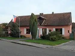 Municipal office | |
 Flag  Coat of arms | |
 Tetov Location in the Czech Republic | |
| Coordinates: 50°4′50″N 15°26′45″E / 50.08056°N 15.44583°E | |
| Country | |
| Region | Pardubice |
| District | Pardubice |
| Founded | 1791 |
| Area | |
• Total | 4.62 km2 (1.78 sq mi) |
| Elevation | 212 m (696 ft) |
| Population (2025-01-01)[1] | |
• Total | 167 |
| • Density | 36/km2 (94/sq mi) |
| Time zone | UTC+1 (CET) |
| • Summer (DST) | UTC+2 (CEST) |
| Postal code | 533 16 |
| Website | www |
Tetov is a municipality and village in Pardubice District in the Pardubice Region of the Czech Republic. It has about 200 inhabitants.
Demographics
| Year | Pop. | ±% |
|---|---|---|
| 1869 | 307 | — |
| 1880 | 323 | +5.2% |
| 1890 | 343 | +6.2% |
| 1900 | 334 | −2.6% |
| 1910 | 376 | +12.6% |
| 1921 | 394 | +4.8% |
| 1930 | 375 | −4.8% |
| 1950 | 283 | −24.5% |
| 1961 | 326 | +15.2% |
| 1970 | 278 | −14.7% |
| 1980 | 248 | −10.8% |
| 1991 | 182 | −26.6% |
| 2001 | 156 | −14.3% |
| 2011 | 161 | +3.2% |
| 2021 | 177 | +9.9% |
| Source: Censuses[2][3] | ||
References
- ^ "Population of Municipalities – 1 January 2025". Czech Statistical Office. 2025-05-16.
- ^ "Historický lexikon obcí České republiky 1869–2011" (in Czech). Czech Statistical Office. 2015-12-21.
- ^ "Population Census 2021: Population by sex". Public Database. Czech Statistical Office. 2021-03-27.
External links
Wikimedia Commons has media related to Tetov.