Lernakert, Shirak
40°34′01″N 43°56′10″E / 40.56694°N 43.93611°E
Lernakert
Լեռնակերտ | |
|---|---|
 | |
 Lernakert 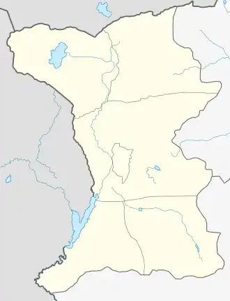 Lernakert | |
| Coordinates: 40°34′01″N 43°56′10″E / 40.56694°N 43.93611°E | |
| Country | Armenia |
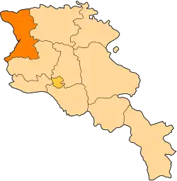
| Province | Shirak |
| Municipality | Artik |
| Population (2011) | |
• Total | 1,412[1] |
| Time zone | UTC+4 |
| • Summer (DST) | UTC+5 |
Lernakert (Armenian: Լեռնակերտ) is a village in the Artik Municipality of the Shirak Province of Armenia. The 10th to 13th-century Makaravank Church, with the church of Surb Sion of 1001 is located 1 mile north of the village. In the gorge below is a small church built on earlier foundations and constructed in the 18th century, with a hermit's cell cut into the cliff face behind.
Demographics
| Year | Pop. | ±% p.a. |
|---|---|---|
| 1831 | 320 | — |
| 1897 | 1,602 | +2.47% |
| 1931 | 1,619 | +0.03% |
| 1970 | 1,466 | −0.25% |
| 1979 | 1,200 | −2.20% |
| 2001 | 1,449 | +0.86% |
| 2011 | 1,412 | −0.26% |
| Source: [2] | ||
Gallery
-
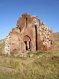 Makaravank Church, 10th-13th centuries
 -
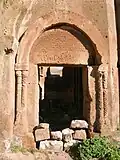 Makaravank Church entry
 -
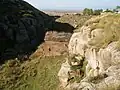 18th-century chapel in gorge below Makaravank
See also
References
- ^ "Shirak (Armenia): Towns and Villages in Municipalities". www.citypopulation.de. Retrieved 2025-07-17.
- ^ Հայաստանի Հանրապետության բնակավայրերի բառարան [Republic of Armenia settlements dictionary] (PDF) (in Armenian). Yerevan: Cadastre Committee of the Republic of Armenia. 2008. Archived from the original (PDF) on 11 March 2018.