Mount Elie de Beaumont
| Mount Elie de Beaumont | |
|---|---|
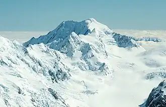 Aerial view from the south | |
| Highest point | |
| Elevation | 3,109 m (10,200 ft)[1] |
| Listing | New Zealand #5 |
| Coordinates | 43°28′54″S 170°19′41″E / 43.48173°S 170.32812°E[1] |
| Geography | |
.png) Mount Elie de Beaumont Location in New Zealand | |
| Location | South Island, New Zealand |
| Parent range | Southern Alps |
Mount Elie de Beaumont is a 3,109 metres (10,200 ft) high mountain in the Southern Alps on the South Island of New Zealand and the northernmost Three-thousander of the country. It is surrounded by several glaciers like Johannes Glacier in the north, Burton Glacier to the east, Times Glacier to the west and Anna Glacier, a tributary to the Tasman Glacier, in the south.[1] It was named by Julius von Haast after the French geologist Jean-Baptiste Élie de Beaumont.[2]
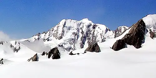
Gallery
References
Wikimedia Commons has media related to Mount Elie de Beaumont.
- ^ a b c "Topographic map". NZTopoMap. Retrieved 30 May 2021.
- ^ "New Zealand Gazetteer". Retrieved 1 December 2022.