Mount Teichelmann
| Mount Teichelmann | |
|---|---|
 | |
| Highest point | |
| Elevation | 3,144 m (10,315 ft)[1] |
| Isolation | 0.21 km (0.13 mi) |
| Coordinates | 43°34′26″S 170°08′49″E / 43.574°S 170.147°E |
| Naming | |
| Etymology | Ebenezer Teichelmann |
| Native name | Rarangiroa |
| Geography | |
.png) Mount Teichelmann Location of Mount Teichelmann in New Zealand | |
| Location | West Coast, New Zealand |
| Parent range | Southern Alps |
Mount Teichelmann (Rarangiroa)[2] is a mountain summit located in the Southern Alps, in the Westland District of New Zealand.[2] The mountain was named after the Austrian surgeon and mountaineer Ebenezer Teichelmann.
Description
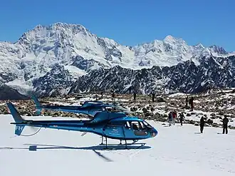
Mount Teichelmann lies on the junction of the Balfour Range and the main range of Southern Alps / Kā Tiritiri o te Moana, between the two highest peaks of the country, 3,724 m (12,218 ft) high Aoraki / Mount Cook and the 3,497 m (11,473 ft) high Mount Tasman.[2] Linda Glacier is found on the southeastern flanks of the peak.[2]
The peak is located at the border between Westland Tai Poutini National Park and Aoraki / Mount Cook National Park.
Geology
Mount Teichelmann is primarily formed by uplifted sandstone, siltstone and mudstone, which was deposited between 201 and 253 million years ago.[3]
References
- ^ "Mount Teichelmann, New Zealand". Peakbagger.com. Retrieved 11 June 2024.
- ^ a b c d "Place name detail: Mount Teichelmann". New Zealand Gazetteer. Land Information New Zealand. Retrieved 11 June 2024.
- ^ "Geologische Karte Neuseelands". GNS Science – Te Pū Ao. Retrieved 16 May 2021.