Mount GEC
| Mount GEC | |
|---|---|
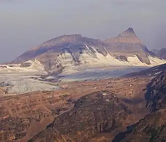 East aspect | |
| Highest point | |
| Elevation | 3,220 m (10,560 ft)[1][a] |
| Prominence | 400 m (1,300 ft)[1] |
| Parent peak | Mount Smythe (3246 m)[1] |
| Listing | Mountains of Alberta |
| Coordinates | 52°20′11″N 117°27′00″W / 52.33639°N 117.45000°W[4] |
| Geography | |
 Mount GEC Location in Alberta | |
| Country | Canada |
| Province | Alberta |
| Protected area | Jasper National Park[5] |
| Parent range | Winston Churchill Range[5] |
| Topo map | NTS 83C6 Sunwapta Peak[4] |
| Climbing | |
| First ascent | 1948 by George Harr, Ellen Wilts, Chuck Wilts[2][1] |
| Easiest route | rock/snow climb |
Mount GEC is a mountain located in the Sunwapta River Valley of Jasper National Park. Gec lies 4 km (2 mi) northwest of Diadem Peak. The mountain was named in 1961 after the first names of the three climbers who made the first ascent — George, Ellen, and Chuck.[2]
See also
References
- ^ a b c d "Mount GEC". Bivouac.com. Retrieved 2013-05-17.
- ^ a b c "Mount Gec". cdnrockiesdatabases.ca. Retrieved 2004-06-05.
- ^ "Topographic map of Mount Gec". opentopomap.org. Retrieved 2021-09-02.
- ^ a b "Mount GEC". Geographical Names Data Base. Natural Resources Canada. Retrieved 2013-05-17.
- ^ a b NTS map sheet 83C06 Sunwapta Peak
- Notes