Nohanent
Nohanent | |
|---|---|
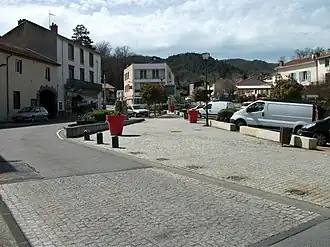 "Place de la Farge" square | |
.svg.png) Coat of arms | |
Location of Nohanent | |
 Nohanent  Nohanent | |
| Coordinates: 45°48′31″N 3°03′20″E / 45.8086°N 3.0556°E | |
| Country | France |
| Region | Auvergne-Rhône-Alpes |
| Department | Puy-de-Dôme |
| Arrondissement | Clermont-Ferrand |
| Canton | Cébazat |
| Intercommunality | Clermont Auvergne Métropole |
| Government | |
| • Mayor (2020–2026) | Laurent Ganet[1] |
Area 1 | 4.2 km2 (1.6 sq mi) |
| Population (2022)[2] | 2,246 |
| • Density | 530/km2 (1,400/sq mi) |
| Time zone | UTC+01:00 (CET) |
| • Summer (DST) | UTC+02:00 (CEST) |
| INSEE/Postal code | 63254 /63830 |
| Elevation | 385–634 m (1,263–2,080 ft) (avg. 500 m or 1,600 ft) |
| Website | ville-nohanent.fr |
| 1 French Land Register data, which excludes lakes, ponds, glaciers > 1 km2 (0.386 sq mi or 247 acres) and river estuaries. | |
Nohanent is commune in the Puy-de-Dôme department in Auvergne-Rhône-Alpes in central France.[3]
Population
| Year | Pop. | ±% p.a. |
|---|---|---|
| 1968 | 1,096 | — |
| 1975 | 1,452 | +4.10% |
| 1982 | 1,595 | +1.35% |
| 1990 | 1,791 | +1.46% |
| 1999 | 1,796 | +0.03% |
| 2007 | 1,867 | +0.49% |
| 2012 | 2,025 | +1.64% |
| 2017 | 2,225 | +1.90% |
| Source: INSEE[4] | ||
See also
References
- ^ "Répertoire national des élus: les maires". data.gouv.fr, Plateforme ouverte des données publiques françaises (in French). 2 December 2020.
- ^ "Populations de référence 2022" (in French). The National Institute of Statistics and Economic Studies. 19 December 2024.
- ^ INSEE commune file
- ^ Population en historique depuis 1968, INSEE
External links
Wikimedia Commons has media related to Nohanent.
- Official Website (in French)