Saurier
Saurier | |
|---|---|
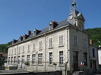 The town hall in Saurier | |
.svg.png) Coat of arms | |
Location of Saurier | |
 Saurier  Saurier | |
| Coordinates: 45°32′17″N 3°02′46″E / 45.538°N 3.046°E | |
| Country | France |
| Region | Auvergne-Rhône-Alpes |
| Department | Puy-de-Dôme |
| Arrondissement | Issoire |
| Canton | Le Sancy |
| Intercommunality | Agglo Pays d'Issoire |
| Government | |
| • Mayor (2020–2026) | Philippe Dubost[1] |
Area 1 | 8.36 km2 (3.23 sq mi) |
| Population (2022)[2] | 248 |
| • Density | 30/km2 (77/sq mi) |
| Time zone | UTC+01:00 (CET) |
| • Summer (DST) | UTC+02:00 (CEST) |
| INSEE/Postal code | 63409 /63320 |
| Elevation | 529–925 m (1,736–3,035 ft) (avg. 561 m or 1,841 ft) |
| 1 French Land Register data, which excludes lakes, ponds, glaciers > 1 km2 (0.386 sq mi or 247 acres) and river estuaries. | |
Saurier (French pronunciation: [soʁje]) is a commune in the Puy-de-Dôme department in Auvergne in central France.[3]
See also
References
- ^ "Répertoire national des élus: les maires" (in French). data.gouv.fr, Plateforme ouverte des données publiques françaises. 13 September 2022.
- ^ "Populations de référence 2022" (in French). The National Institute of Statistics and Economic Studies. 19 December 2024.
- ^ INSEE commune file
Wikimedia Commons has media related to Saurier.