Osek nad Bečvou
Osek nad Bečvou | |
|---|---|
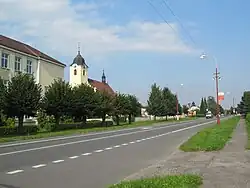 Main street and the Church of the Exaltation of the Holy Cross | |
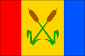 Flag 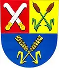 Coat of arms | |
 Osek nad Bečvou Location in the Czech Republic | |
| Coordinates: 49°30′40″N 17°31′42″E / 49.51111°N 17.52833°E | |
| Country | |
| Region | Olomouc |
| District | Přerov |
| First mentioned | 1374 |
| Area | |
• Total | 13.03 km2 (5.03 sq mi) |
| Elevation | 225 m (738 ft) |
| Population (2025-01-01)[1] | |
• Total | 1,358 |
| • Density | 100/km2 (270/sq mi) |
| Time zone | UTC+1 (CET) |
| • Summer (DST) | UTC+2 (CEST) |
| Postal code | 751 22 |
| Website | www |
Osek nad Bečvou is a municipality and village in Přerov District in the Olomouc Region of the Czech Republic. It has about 1,400 inhabitants.
Osek nad Bečvou lies approximately 9 kilometres (6 mi) north-east of Přerov, 22 km (14 mi) south-east of Olomouc, and 232 km (144 mi) east of Prague. It lies on the Bečva River.
Demographics
| Year | Pop. | ±% |
|---|---|---|
| 1869 | 894 | — |
| 1880 | 1,061 | +18.7% |
| 1890 | 1,180 | +11.2% |
| 1900 | 1,235 | +4.7% |
| 1910 | 1,269 | +2.8% |
| 1921 | 1,254 | −1.2% |
| 1930 | 1,370 | +9.3% |
| 1950 | 1,211 | −11.6% |
| 1961 | 1,255 | +3.6% |
| 1970 | 1,158 | −7.7% |
| 1980 | 1,067 | −7.9% |
| 1991 | 1,041 | −2.4% |
| 2001 | 1,074 | +3.2% |
| 2011 | 1,175 | +9.4% |
| 2021 | 1,250 | +6.4% |
| Source: Censuses[2][3] | ||
References
- ^ "Population of Municipalities – 1 January 2025". Czech Statistical Office. 2025-05-16.
- ^ "Historický lexikon obcí České republiky 1869–2011" (in Czech). Czech Statistical Office. 2015-12-21.
- ^ "Population Census 2021: Population by sex". Public Database. Czech Statistical Office. 2021-03-27.
External links
Wikimedia Commons has media related to Osek nad Bečvou.