Otehake River
| Otehake River | |
|---|---|
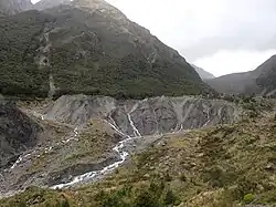 Taruahuna Pass. Headwaters of the Otehake River (West Branch) New Zealand | |
Route of the Otehake River | |
.png) Mouth of the Otehake River  Otehake River (South Island) | |
| Location | |
| Country | New Zealand |
| Physical characteristics | |
| Source | Southern Alps (West Branch) |
| • coordinates | 42°52′53″S 171°40′48″E / 42.8814°S 171.6800°E |
| 2nd source | Southern Alps (East Branch) |
| • coordinates | 42°54′22″S 171°41′24″E / 42.9061°S 171.6901°E |
| Mouth | |
• location | Taramakau River |
• coordinates | 42°45′46″S 171°43′23″E / 42.7629°S 171.7231°E |
| Basin features | |
| Progression | Otehake River → Taramakau River → Tasman Sea |
| Tributaries | |
| • left | Whaiti Stream |
| • right | Koropuku Creek |
Otehake River is located on the West Coast of the South Island of New Zealand. It flows northward through the Arthur's Pass National Park and into the Taramakau River.[1]
Wikimedia Commons has media related to Otehake River.
References