Rabouillet
Rabouillet
Rabolhet | |
|---|---|
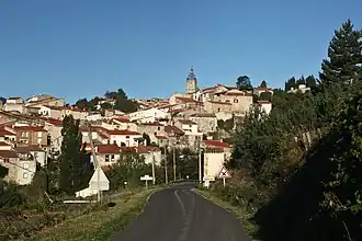 A general view of the village of Rabouillet | |
.svg.png) Coat of arms | |
Location of Rabouillet | |
 Rabouillet  Rabouillet | |
| Coordinates: 42°43′56″N 2°23′25″E / 42.7322°N 2.3903°E | |
| Country | France |
| Region | Occitania |
| Department | Pyrénées-Orientales |
| Arrondissement | Prades |
| Canton | La Vallée de l'Agly |
| Intercommunality | Agly Fenouillèdes |
| Government | |
| • Mayor (2020–2026) | Auguste Blanc[1] |
Area 1 | 19.21 km2 (7.42 sq mi) |
| Population (2022)[2] | 87 |
| • Density | 4.5/km2 (12/sq mi) |
| Time zone | UTC+01:00 (CET) |
| • Summer (DST) | UTC+02:00 (CEST) |
| INSEE/Postal code | 66156 /66730 |
| Elevation | 600–1,529 m (1,969–5,016 ft) (avg. 658 m or 2,159 ft) |
| 1 French Land Register data, which excludes lakes, ponds, glaciers > 1 km2 (0.386 sq mi or 247 acres) and river estuaries. | |
Rabouillet (French pronunciation: [ʁabujɛ] ⓘ; Occitan: Rebolhet) is a commune in the Pyrénées-Orientales department in southern France.[3]
Geography
Rabouillet is in the canton of La Vallée de l'Agly and in the arrondissement of Prades.

Population
| Year | Pop. | ±% p.a. |
|---|---|---|
| 1968 | 139 | — |
| 1975 | 127 | −1.28% |
| 1982 | 106 | −2.55% |
| 1990 | 101 | −0.60% |
| 1999 | 85 | −1.90% |
| 2007 | 105 | +2.68% |
| 2012 | 111 | +1.12% |
| 2017 | 103 | −1.48% |
| Source: INSEE[4] | ||
See also
References
- ^ "Répertoire national des élus: les maires" (in French). data.gouv.fr, Plateforme ouverte des données publiques françaises. 13 September 2022.
- ^ "Populations de référence 2022" (in French). The National Institute of Statistics and Economic Studies. 19 December 2024.
- ^ INSEE commune file
- ^ Population en historique depuis 1968, INSEE
Wikimedia Commons has media related to Rabouillet.