Rastenfeld
Rastenfeld | |
|---|---|
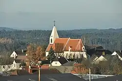 Rastenfeld parish church | |
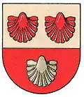 Coat of arms | |
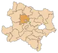
 Rastenfeld Location within Austria | |
| Coordinates: 48°34′N 15°19′E / 48.567°N 15.317°E | |
| Country | Austria |
| State | Lower Austria |
| District | Krems-Land |
| Government | |
| • Mayor | Gerhard Wandl |
| Area | |
• Total | 47.62 km2 (18.39 sq mi) |
| Elevation | 579 m (1,900 ft) |
| Population (2018-01-01)[2] | |
• Total | 1,551 |
| • Density | 33/km2 (84/sq mi) |
| Time zone | UTC+1 (CET) |
| • Summer (DST) | UTC+2 (CEST) |
| Postal code | 3532 |
| Area code | 02826 |
| Website | www.rastenfeld.at |
Rastenfeld is a town in the district of Krems-Land in the Austrian state of Lower Austria.
Population
| Year | Pop. | ±% |
|---|---|---|
| 1971 | 1,517 | — |
| 1981 | 1,383 | −8.8% |
| 1991 | 1,334 | −3.5% |
| 2001 | 1,367 | +2.5% |
| 2011 | 1,412 | +3.3% |
| 2021 | 1,601 | +13.4% |
References
- ^ "Dauersiedlungsraum der Gemeinden Politischen Bezirke und Bundesländer - Gebietsstand 1.1.2018". Statistics Austria. Retrieved 10 March 2019.
- ^ "Einwohnerzahl 1.1.2018 nach Gemeinden mit Status, Gebietsstand 1.1.2018". Statistics Austria. Retrieved 9 March 2019.