Stratzing
Stratzing | |
|---|---|
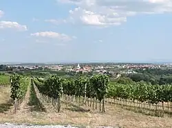 View from vineyard | |
 Coat of arms | |
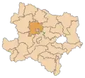
 Stratzing Location within Austria | |
| Coordinates: 48°27′N 15°36′E / 48.450°N 15.600°E | |
| Country | Austria |
| State | Lower Austria |
| District | Krems-Land |
| Government | |
| • Mayor | Josef Schmid (ÖVP) |
| Area | |
• Total | 5.86 km2 (2.26 sq mi) |
| Elevation | 352 m (1,155 ft) |
| Population (2018-01-01)[2] | |
• Total | 827 |
| • Density | 140/km2 (370/sq mi) |
| Time zone | UTC+1 (CET) |
| • Summer (DST) | UTC+2 (CEST) |
| Postal code | 3552 |
| Area code | 02719 |
| Website | www.stratzing.at |
Stratzing is a town in the district of Krems-Land in the Austrian state of Lower Austria.
Population
| Year | Pop. | ±% |
|---|---|---|
| 1971 | 508 | — |
| 1981 | 520 | +2.4% |
| 1991 | 691 | +32.9% |
| 2001 | 797 | +15.3% |
| 2011 | 807 | +1.3% |
| 2021 | 906 | +12.3% |
References
- ^ "Dauersiedlungsraum der Gemeinden Politischen Bezirke und Bundesländer - Gebietsstand 1.1.2018". Statistics Austria. Retrieved 10 March 2019.
- ^ "Einwohnerzahl 1.1.2018 nach Gemeinden mit Status, Gebietsstand 1.1.2018". Statistics Austria. Retrieved 9 March 2019.
Wikimedia Commons has media related to Stratzing.