Ružiná
Ružiná
Rózsaszállás | |
|---|---|
 | |
 Flag | |
 Ružiná Location of Ružiná in the Banská Bystrica Region  Ružiná Location of Ružiná in Slovakia | |
| Coordinates: 48°26′N 19°33′E / 48.43°N 19.55°E | |
| Country | |
| Region | |
| District | Lučenec District |
| First mentioned | 1499 |
| Government | |
| • Mayor | Jozef Líška |
| Area | |
• Total | 10.81 km2 (4.17 sq mi) |
| Elevation | 268 m (879 ft) |
| Population (2021)[3] | |
• Total | 838 |
| Time zone | UTC+1 (CET) |
| • Summer (DST) | UTC+2 (CEST) |
| Postal code | 985 52[2] |
| Area code | +421 47[2] |
| Car plate | LC |
| Website | www |
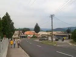
Ružiná (Hungarian: Rózsaszállás) is a village and municipality in the Lučenec District in the Banská Bystrica Region of Slovakia.[4] The town's attractions include the Ružiná dam[5] and the Divín Castle.[6] The town is home to the Church of St. František Assiský-the oldest building in the town, dating back to the mid-18th century.[7]
References
- ^ "Hustota obyvateľstva - obce [om7014rr_ukaz: Rozloha (Štvorcový meter)]". www.statistics.sk (in Slovak). Statistical Office of the Slovak Republic. 2022-03-31. Retrieved 2022-03-31.
- ^ a b c "Základná charakteristika". www.statistics.sk (in Slovak). Statistical Office of the Slovak Republic. 2015-04-17. Retrieved 2022-03-31.
- ^ "Počet obyvateľov podľa pohlavia - obce (ročne)". www.statistics.sk (in Slovak). Statistical Office of the Slovak Republic. 2022-03-31. Retrieved 2022-03-31.
- ^ "Obec Ružiná - Oficiálna stránka obce Ružiná". www.ruzina.eu. Retrieved 2021-10-29.
- ^ "Ružiná dam - Slovakia.travel". slovakia.travel. Retrieved 2021-10-29.
- ^ "The Divín Castle - Slovakia.travel". slovakia.travel. Retrieved 2021-10-29.
- ^ "Kostol Ružiná". kostol--ruzina5-webnode-sk.translate.goog. Retrieved 2021-10-29.
External links
 Media related to Ružiná at Wikimedia Commons
- Official website

- http://www.statistics.sk/mosmis/eng/run.html