Ruffré-Mendola
Ruffré-Mendola | |
|---|---|
| Comune di Ruffré-Mendola | |
Location of Ruffré-Mendola | |
 Ruffré-Mendola Location of Ruffré-Mendola in Italy 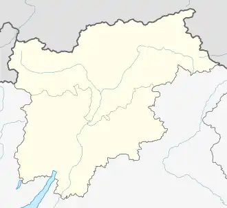 Ruffré-Mendola Ruffré-Mendola (Trentino-Alto Adige/Südtirol) | |
| Coordinates: 46°25′N 11°11′E / 46.417°N 11.183°E | |
| Country | Italy |
| Region | Trentino-Alto Adige/Südtirol |
| Province | Trentino (TN) |
| Area | |
• Total | 6 km2 (2 sq mi) |
| Elevation | 1,175 m (3,855 ft) |
| Population (31 October 2007)ISTAT | |
• Total | 432 |
| • Density | 72/km2 (190/sq mi) |
| Demonym | Ruffredani |
| Time zone | UTC+1 (CET) |
| • Summer (DST) | UTC+2 (CEST) |
| Postal code | 38010 |
| Dialing code | 0463 |
| Website | Official website |
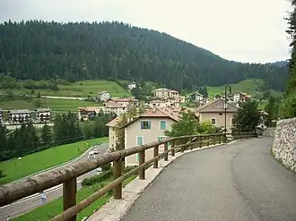
Ruffré-Mendola (Rufré-Méndola in local dialect) is a comune (municipality) in Trentino in the northern Italian region Trentino-Alto Adige/Südtirol, located about 40 kilometres (25 mi) north of Trento. As of 31 December 2004, it had a population of 444 and an area of 6.6 square kilometres (2.5 sq mi).[2][3]
It borders the following municipalities: Sarnonico, Caldaro and Cavareno.
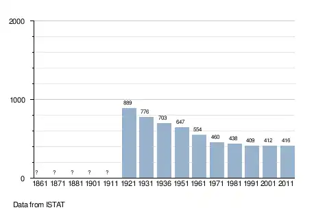
Demographic evolution
References
- ^ "Superficie di Comuni Province e Regioni italiane al 9 ottobre 2011". Italian National Institute of Statistics. Retrieved 16 March 2019.
- ^ All demographics and other statistics: Italian statistical institute ISTAT.
- ^ Ruffré-Mendola, tetto instabile, chiuso l'oratorio
External links
- (in Italian) Homepage of the city