Saint-Bonnot
Saint-Bonnot | |
|---|---|
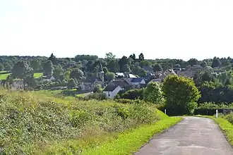 A general view of Saint-Bonnot | |
Location of Saint-Bonnot | |
 Saint-Bonnot  Saint-Bonnot | |
| Coordinates: 47°14′40″N 3°18′54″E / 47.2444°N 3.31500°E | |
| Country | France |
| Region | Bourgogne-Franche-Comté |
| Department | Nièvre |
| Arrondissement | Cosne-Cours-sur-Loire |
| Canton | La Charité-sur-Loire |
| Government | |
| • Mayor (2022–2026) | Marie-Hélène Trefouel[1] |
Area 1 | 16.14 km2 (6.23 sq mi) |
| Population (2022)[2] | 149 |
| • Density | 9.2/km2 (24/sq mi) |
| Time zone | UTC+01:00 (CET) |
| • Summer (DST) | UTC+02:00 (CEST) |
| INSEE/Postal code | 58234 /58700 |
| Elevation | 247–332 m (810–1,089 ft) |
| 1 French Land Register data, which excludes lakes, ponds, glaciers > 1 km2 (0.386 sq mi or 247 acres) and river estuaries. | |
Saint-Bonnot (French pronunciation: [sɛ̃ bɔno]) is a commune in the Nièvre department in central France.[3]
See also
References
- ^ "Répertoire national des élus: les maires" (in French). data.gouv.fr, Plateforme ouverte des données publiques françaises. 30 November 2023.
- ^ "Populations de référence 2022" (in French). The National Institute of Statistics and Economic Studies. 19 December 2024.
- ^ INSEE commune file
Wikimedia Commons has media related to Saint-Bonnot.