Sils, Spain
Sils | |
|---|---|
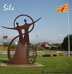 Monument at entrance to Sils | |
 Flag  Coat of arms | |
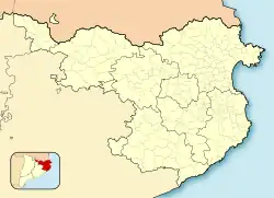 Sils Location in Catalonia  Sils Sils (Spain) | |
| Coordinates: 41°48′N 2°45′E / 41.800°N 2.750°E | |
| Country | |
| Community | |
| Province | Girona |
| Comarca | Selva |
| Government | |
| • Mayor | Eduard Colomé Ribas (2019)[1] |
| Area | |
• Total | 29.9 km2 (11.5 sq mi) |
| Elevation | 76 m (249 ft) |
| Population (2018)[3] | |
• Total | 5,969 |
| • Density | 200/km2 (520/sq mi) |
| Demonym(s) | Silenc, silenca |
| Website | www |
Sils (Catalan pronunciation: [ˈsils]) is a municipality in the comarca of Selva, in Catalonia, Spain. It is situated next to a former lake, which was drained in the nineteenth century. Autopista AP-7 and road N-II run through the municipality, and there is a Renfe railway station on the line between Barcelona and Girona.
Demography
| 1900 | 1930 | 1950 | 1970 | 1986 | 2007 |
|---|---|---|---|---|---|
| 1221 | 1362 | 1586 | 1923 | 2058 | 4347 |
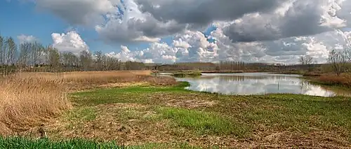
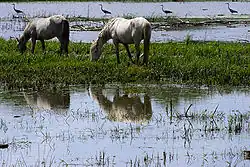
Lake Sils
Formerly a 7 km2 lake, known as Llac de Sils or Estany de Sils existed close to this town, but it was desiccated in the 19th century and only a few residual wetlands remain. Presently some efforts are under way to try to reestablish a pond restoring a sample of the original vegetation.[4]
 |
 |
References
- ^ "Ajuntament de Sils". Generalitat of Catalonia. Retrieved 2015-11-13.
- ^ "El municipi en xifres: Sils". Statistical Institute of Catalonia. Retrieved 2015-11-23.
- ^ Municipal Register of Spain 2018. National Statistics Institute.
- ^ Estany de Sils - Una breu història
- Panareda Clopés, Josep Maria; Rios Calvet, Jaume; Rabella Vives, Josep Maria (1989). Guia de Catalunya, Barcelona: Caixa de Catalunya. ISBN 84-87135-01-3 (Spanish). ISBN 84-87135-02-1 (Catalan).
External links
- Official website (in Catalan)
- Government data pages (in Catalan)
Places adjacent to Sils, Spain | |
|---|---|