Spencer Township, Jennings County, Indiana
Spencer Township | |
|---|---|
 Location in Jennings County | |
| Coordinates: 38°58′24″N 85°44′41″W / 38.97333°N 85.74472°W | |
| Country | United States |
| State | Indiana |
| County | Jennings |
| Government | |
| • Type | Indiana township |
| Area | |
• Total | 49.23 sq mi (127.5 km2) |
| • Land | 48.91 sq mi (126.7 km2) |
| • Water | 0.32 sq mi (0.8 km2) 0.65% |
| Elevation | 646 ft (197 m) |
| Population (2020) | |
• Total | 2,416 |
| • Density | 49/sq mi (19/km2) |
| GNIS feature ID | 0453861 |
Spencer Township is one of eleven townships in Jennings County, Indiana, United States. As of the 2020 census, its population was 2,416 (up from 2,326 at 2010[1]) and it contained 938 housing units.[2]
| Census | Pop. | Note | %± |
|---|---|---|---|
| 1890 | 1,410 | — | |
| 1900 | 1,584 | 12.3% | |
| 1910 | 1,347 | −15.0% | |
| 1920 | 1,215 | −9.8% | |
| 1930 | 981 | −19.3% | |
| 1940 | 1,123 | 14.5% | |
| 1950 | 1,166 | 3.8% | |
| 1960 | 1,421 | 21.9% | |
| 1970 | 1,570 | 10.5% | |
| 1980 | 2,093 | 33.3% | |
| 1990 | 1,980 | −5.4% | |
| 2000 | 2,073 | 4.7% | |
| 2010 | 2,326 | 12.2% | |
| 2020 | 2,416 | 3.9% | |
| Source: US Decennial Census[3] | |||
Geography
According to the 2010 census, the township has a total area of 49.23 square miles (127.5 km2), of which 48.91 square miles (126.7 km2) (or 99.35%) is land and 0.32 square miles (0.83 km2) (or 0.65%) is water.[1] The streams of Indian Creek, Little Mutton Creek, Powder Creek, Storm Creek, Tea Creek and Twomile Creek run through this township.
Unincorporated towns
- Four Corners
- Hayden
Adjacent townships
- Geneva Township (north)
- Center Township (east)
- Vernon Township (east)
- Lovett Township (southeast)
- Marion Township (south)
- Vernon Township, Jackson County (southwest)
- Washington Township, Jackson County (southwest)
- Jackson Township, Jackson County (west)
- Redding Township, Jackson County (west)
Cemeteries
The township contains eight cemeteries: Barkman, Hunt, Myers, Saint Catherines, Saint James, Sixmile, Whitcomb and Wohrer.
Major highways
References
- ^ a b "Population, Housing Units, Area, and Density: 2010 - County -- County Subdivision and Place -- 2010 Census Summary File 1". United States Census. Archived from the original on February 12, 2020. Retrieved May 10, 2013.
- ^ "Explore Census Data". data.census.gov. Retrieved April 10, 2024.
- ^ "Township Census Counts: STATS Indiana".
External links
Municipalities and communities of Jennings County, Indiana, United States | ||
|---|---|---|
| City | 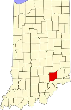 | |
| Town | ||
| Townships | ||
| CDPs | ||
| Other communities | ||
| Footnotes | ‡This populated place also has portions in an adjacent county or counties | |