Sudslava
Sudslava | |
|---|---|
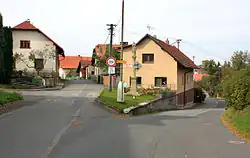 Crossroads with a Marian column | |
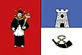 Flag 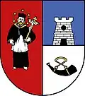 Coat of arms | |
 Sudslava Location in the Czech Republic | |
| Coordinates: 50°2′26″N 16°17′11″E / 50.04056°N 16.28639°E | |
| Country | |
| Region | Pardubice |
| District | Ústí nad Orlicí |
| First mentioned | 1349 |
| Area | |
• Total | 4.41 km2 (1.70 sq mi) |
| Elevation | 432 m (1,417 ft) |
| Population (2025-01-01)[1] | |
• Total | 167 |
| • Density | 38/km2 (98/sq mi) |
| Time zone | UTC+1 (CET) |
| • Summer (DST) | UTC+2 (CEST) |
| Postal code | 561 13 |
| Website | www |
Sudslava (German: Cuslau) is a municipality and village in Ústí nad Orlicí District in the Pardubice Region of the Czech Republic. It has about 200 inhabitants.
Sudslava lies approximately 11 kilometres (7 mi) north-west of Ústí nad Orlicí, 37 km (23 mi) east of Pardubice, and 134 km (83 mi) east of Prague.
Demographics
| Year | Pop. | ±% |
|---|---|---|
| 1869 | 359 | — |
| 1880 | 326 | −9.2% |
| 1890 | 329 | +0.9% |
| 1900 | 307 | −6.7% |
| 1910 | 327 | +6.5% |
| 1921 | 314 | −4.0% |
| 1930 | 285 | −9.2% |
| 1950 | 243 | −14.7% |
| 1961 | 225 | −7.4% |
| 1970 | 197 | −12.4% |
| 1980 | 191 | −3.0% |
| 1991 | 152 | −20.4% |
| 2001 | 178 | +17.1% |
| 2011 | 180 | +1.1% |
| 2021 | 169 | −6.1% |
| Source: Censuses[2][3] | ||
References
- ^ "Population of Municipalities – 1 January 2025". Czech Statistical Office. 2025-05-16.
- ^ "Historický lexikon obcí České republiky 1869–2011" (in Czech). Czech Statistical Office. 2015-12-21.
- ^ "Population Census 2021: Population by sex". Public Database. Czech Statistical Office. 2021-03-27.
External links
Wikimedia Commons has media related to Sudslava.