Vračovice-Orlov
Vračovice-Orlov | |
|---|---|
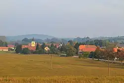 Vračovice as seen from Orlov | |
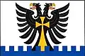 Flag 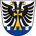 Coat of arms | |
 Vračovice-Orlov Location in the Czech Republic | |
| Coordinates: 49°57′9″N 16°15′8″E / 49.95250°N 16.25222°E | |
| Country | |
| Region | Pardubice |
| District | Ústí nad Orlicí |
| First mentioned | 1349 |
| Area | |
• Total | 2.91 km2 (1.12 sq mi) |
| Elevation | 298 m (978 ft) |
| Population (2025-01-01)[1] | |
• Total | 171 |
| • Density | 59/km2 (150/sq mi) |
| Time zone | UTC+1 (CET) |
| • Summer (DST) | UTC+2 (CEST) |
| Postal code | 566 01 |
| Website | www |
Vračovice-Orlov (German: Wracowitz) is a municipality in Ústí nad Orlicí District in the Pardubice Region of the Czech Republic. It has about 200 inhabitants.
Vračovice-Orlov lies approximately 11 kilometres (7 mi) west of Ústí nad Orlicí, 36 km (22 mi) east of Pardubice, and 132 km (82 mi) east of Prague.
Administrative division
Vračovice-Orlov consists of two municipal parts (in brackets population according to the 2021 census):[2]
- Vračovice (73)
- Orlov (78)
Demographics
| Year | Pop. | ±% |
|---|---|---|
| 1869 | 342 | — |
| 1880 | 365 | +6.7% |
| 1890 | 320 | −12.3% |
| 1900 | 300 | −6.2% |
| 1910 | 310 | +3.3% |
| 1921 | 290 | −6.5% |
| 1930 | 292 | +0.7% |
| 1950 | 211 | −27.7% |
| 1961 | 199 | −5.7% |
| 1970 | 194 | −2.5% |
| 1980 | 184 | −5.2% |
| 1991 | 169 | −8.2% |
| 2001 | 152 | −10.1% |
| 2011 | 182 | +19.7% |
| 2021 | 151 | −17.0% |
| Source: Censuses[3][4] | ||
References
- ^ "Population of Municipalities – 1 January 2025". Czech Statistical Office. 2025-05-16.
- ^ "Public Census 2021 – basic data". Public Database (in Czech). Czech Statistical Office. 2022.
- ^ "Historický lexikon obcí České republiky 1869–2011" (in Czech). Czech Statistical Office. 2015-12-21.
- ^ "Population Census 2021: Population by sex". Public Database. Czech Statistical Office. 2021-03-27.
External links
Wikimedia Commons has media related to Vračovice-Orlov.