Těchlovice (Děčín District)
Těchlovice | |
|---|---|
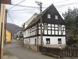 Half-timbered house in the centre of Těchlovice | |
 Flag  Coat of arms | |
 Těchlovice Location in the Czech Republic | |
| Coordinates: 50°41′47″N 14°12′18″E / 50.69639°N 14.20500°E | |
| Country | |
| Region | Ústí nad Labem |
| District | Děčín |
| First mentioned | 1352 |
| Area | |
• Total | 10.49 km2 (4.05 sq mi) |
| Elevation | 145 m (476 ft) |
| Population (2025-01-01)[1] | |
• Total | 497 |
| • Density | 47/km2 (120/sq mi) |
| Time zone | UTC+1 (CET) |
| • Summer (DST) | UTC+2 (CEST) |
| Postal code | 405 02 |
| Website | www |
Těchlovice (German: Tichlowitz) is a municipality and village in Děčín District in the Ústí nad Labem Region of the Czech Republic. It has about 500 inhabitants.
Těchlovice lies approximately 9 kilometres (6 mi) south of Děčín, 13 km (8 mi) east of Ústí nad Labem, and 70 km (43 mi) north of Prague.
Demographics
| Year | Pop. | ±% |
|---|---|---|
| 1869 | 860 | — |
| 1880 | 922 | +7.2% |
| 1890 | 978 | +6.1% |
| 1900 | 1,161 | +18.7% |
| 1910 | 1,206 | +3.9% |
| 1921 | 1,131 | −6.2% |
| 1930 | 1,230 | +8.8% |
| 1950 | 709 | −42.4% |
| 1961 | 688 | −3.0% |
| 1970 | 652 | −5.2% |
| 1980 | 564 | −13.5% |
| 1991 | 442 | −21.6% |
| 2001 | 439 | −0.7% |
| 2011 | 521 | +18.7% |
| 2021 | 514 | −1.3% |
| Source: Censuses[2][3] | ||
References
- ^ "Population of Municipalities – 1 January 2025". Czech Statistical Office. 2025-05-16.
- ^ "Historický lexikon obcí České republiky 1869–2011" (in Czech). Czech Statistical Office. 2015-12-21.
- ^ "Population Census 2021: Population by sex". Public Database. Czech Statistical Office. 2021-03-27.
External links
Wikimedia Commons has media related to Těchlovice (Děčín District).