Větřkovice
Větřkovice | |
|---|---|
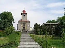 Church of the Assumption of the Virgin Mary | |
 Flag  Coat of arms | |
 Větřkovice Location in the Czech Republic | |
| Coordinates: 49°46′50″N 17°49′14″E / 49.78056°N 17.82056°E | |
| Country | |
| Region | Moravian-Silesian |
| District | Opava |
| Founded | 1298 |
| Area | |
• Total | 17.84 km2 (6.89 sq mi) |
| Elevation | 462 m (1,516 ft) |
| Population (2025-01-01)[1] | |
• Total | 779 |
| • Density | 44/km2 (110/sq mi) |
| Time zone | UTC+1 (CET) |
| • Summer (DST) | UTC+2 (CEST) |
| Postal code | 747 43 |
| Website | www |
Větřkovice is a municipality and village in Opava District in the Moravian-Silesian Region of the Czech Republic. It has about 800 inhabitants.
Administrative division
Větřkovice consists of two municipal parts (in brackets population according to the 2021 census):[2]
- Větřkovice (678)
- Nové Vrbno (25)
History
Větřkovice was founded in 1298 and belongs among the few settlements that have preserved the foundation charter.[3]
Demographics
| Year | Pop. | ±% |
|---|---|---|
| 1869 | 811 | — |
| 1880 | 926 | +14.2% |
| 1890 | 859 | −7.2% |
| 1900 | 827 | −3.7% |
| 1910 | 859 | +3.9% |
| 1921 | 869 | +1.2% |
| 1930 | 839 | −3.5% |
| 1950 | 584 | −30.4% |
| 1961 | 641 | +9.8% |
| 1970 | 640 | −0.2% |
| 1980 | 728 | +13.7% |
| 1991 | 799 | +9.8% |
| 2001 | 780 | −2.4% |
| 2011 | 730 | −6.4% |
| 2021 | 703 | −3.7% |
| Source: Censuses[4][5] | ||
References
- ^ "Population of Municipalities – 1 January 2025". Czech Statistical Office. 2025-05-16.
- ^ "Public Census 2021 – basic data". Public Database (in Czech). Czech Statistical Office. 2022.
- ^ "Historie" (in Czech). Obec Větřkovice. Retrieved 2022-03-04.
- ^ "Historický lexikon obcí České republiky 1869–2011" (in Czech). Czech Statistical Office. 2015-12-21.
- ^ "Population Census 2021: Population by sex". Public Database. Czech Statistical Office. 2021-03-27.
External links
Wikimedia Commons has media related to Větřkovice.