Závada (Opava District)
Závada | |
|---|---|
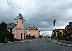 Centre of Závada | |
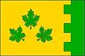 Flag 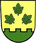 Coat of arms | |
 Závada Location in the Czech Republic | |
| Coordinates: 49°59′29″N 17°57′39″E / 49.99139°N 17.96083°E | |
| Country | |
| Region | Moravian-Silesian |
| District | Opava |
| First mentioned | 1349 |
| Area | |
• Total | 5.27 km2 (2.03 sq mi) |
| Elevation | 262 m (860 ft) |
| Population (2025-01-01)[1] | |
• Total | 620 |
| • Density | 120/km2 (300/sq mi) |
| Time zone | UTC+1 (CET) |
| • Summer (DST) | UTC+2 (CEST) |
| Postal code | 747 19 |
| Website | www |
Závada (German: Zawada bei Beneschau, Polish: Zawada) is a municipality and village in Opava District in the Moravian-Silesian Region of the Czech Republic. It has about 600 inhabitants. It is part of the historic Hlučín Region.
History
The first written mention of Závada is from 1349.[2]
Demographics
| Year | Pop. | ±% |
|---|---|---|
| 1869 | 379 | — |
| 1880 | 378 | −0.3% |
| 1890 | 419 | +10.8% |
| 1900 | 415 | −1.0% |
| 1910 | 448 | +8.0% |
| 1921 | 461 | +2.9% |
| 1930 | 424 | −8.0% |
| 1950 | 406 | −4.2% |
| 1961 | 515 | +26.8% |
| 1970 | 521 | +1.2% |
| 1980 | 572 | +9.8% |
| 1991 | 564 | −1.4% |
| 2001 | 576 | +2.1% |
| 2011 | 574 | −0.3% |
| 2021 | 573 | −0.2% |
| Source: Censuses[3][4] | ||
References
- ^ "Population of Municipalities – 1 January 2025". Czech Statistical Office. 2025-05-16.
- ^ "Historie obce" (in Czech). Obec Závada. Retrieved 2022-03-02.
- ^ "Historický lexikon obcí České republiky 1869–2011" (in Czech). Czech Statistical Office. 2015-12-21.
- ^ "Population Census 2021: Population by sex". Public Database. Czech Statistical Office. 2021-03-27.
External links
Wikimedia Commons has media related to Závada.