Vroville
Vroville | |
|---|---|
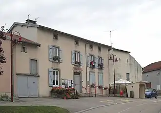 The town hall in Vroville | |
Location of Vroville | |
 Vroville  Vroville | |
| Coordinates: 48°17′15″N 6°10′22″E / 48.2875°N 6.1728°E | |
| Country | France |
| Region | Grand Est |
| Department | Vosges |
| Arrondissement | Neufchâteau |
| Canton | Mirecourt |
| Intercommunality | Mirecourt Dompaire |
| Government | |
| • Mayor (2020–2026) | Stéphane Bisch[1] |
Area 1 | 6.83 km2 (2.64 sq mi) |
| Population (2022)[2] | 133 |
| • Density | 19/km2 (50/sq mi) |
| Time zone | UTC+01:00 (CET) |
| • Summer (DST) | UTC+02:00 (CEST) |
| INSEE/Postal code | 88525 /88500 |
| Elevation | 272–392 m (892–1,286 ft) (avg. 300 m or 980 ft) |
| 1 French Land Register data, which excludes lakes, ponds, glaciers > 1 km2 (0.386 sq mi or 247 acres) and river estuaries. | |
Vroville (French pronunciation: [vʁɔvil] ⓘ) is a commune in the Vosges department in Grand Est in northeastern France.
Population
| Year | Pop. | ±% p.a. |
|---|---|---|
| 1968 | 115 | — |
| 1975 | 105 | −1.29% |
| 1982 | 120 | +1.93% |
| 1990 | 130 | +1.01% |
| 1999 | 131 | +0.09% |
| 2007 | 139 | +0.74% |
| 2012 | 138 | −0.14% |
| 2017 | 133 | −0.74% |
| Source: INSEE[3] | ||
Geography
The river Madon flows through the commune.
See also
References
- ^ "Répertoire national des élus: les maires". data.gouv.fr, Plateforme ouverte des données publiques françaises (in French). 2 December 2020.
- ^ "Populations de référence 2022" (in French). The National Institute of Statistics and Economic Studies. 19 December 2024.
- ^ Population en historique depuis 1968, INSEE
Wikimedia Commons has media related to Vroville.