Újezd u Černé Hory
Újezd u Černé Hory | |
|---|---|
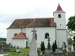 Church of All Saints | |
 Flag  Coat of arms | |
 Újezd u Černé Hory Location in the Czech Republic | |
| Coordinates: 49°22′7″N 16°32′28″E / 49.36861°N 16.54111°E | |
| Country | |
| Region | South Moravian |
| District | Blansko |
| First mentioned | 1308 |
| Area | |
• Total | 4.50 km2 (1.74 sq mi) |
| Elevation | 365 m (1,198 ft) |
| Population (2025-01-01)[1] | |
• Total | 287 |
| • Density | 64/km2 (170/sq mi) |
| Time zone | UTC+1 (CET) |
| • Summer (DST) | UTC+2 (CEST) |
| Postal code | 679 22 |
| Website | www |
Újezd u Černé Hory is a municipality and village in Blansko District in the South Moravian Region of the Czech Republic. It has about 300 inhabitants.
Újezd u Černé Hory lies approximately 8 kilometres (5 mi) west of Blansko, 20 km (12 mi) north of Brno, and 173 km (107 mi) south-east of Prague.
Demographics
| Year | Pop. | ±% |
|---|---|---|
| 1869 | 336 | — |
| 1880 | 343 | +2.1% |
| 1890 | 311 | −9.3% |
| 1900 | 339 | +9.0% |
| 1910 | 358 | +5.6% |
| 1921 | 351 | −2.0% |
| 1930 | 347 | −1.1% |
| 1950 | 298 | −14.1% |
| 1961 | 297 | −0.3% |
| 1970 | 268 | −9.8% |
| 1980 | 325 | +21.3% |
| 1991 | 280 | −13.8% |
| 2001 | 254 | −9.3% |
| 2011 | 239 | −5.9% |
| 2021 | 279 | +16.7% |
| Source: Censuses[2][3] | ||
References
- ^ "Population of Municipalities – 1 January 2025". Czech Statistical Office. 2025-05-16.
- ^ "Historický lexikon obcí České republiky 1869–2011" (in Czech). Czech Statistical Office. 2015-12-21.
- ^ "Population Census 2021: Population by sex". Public Database. Czech Statistical Office. 2021-03-27.
External links
Wikimedia Commons has media related to Újezd u Černé Hory.