Ústup
Ústup | |
|---|---|
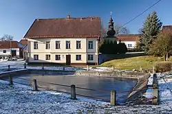 Municipal office in the centre of Ústup | |
 Ústup Location in the Czech Republic | |
| Coordinates: 49°33′54″N 16°27′47″E / 49.56500°N 16.46306°E | |
| Country | |
| Region | South Moravian |
| District | Blansko |
| First mentioned | 1374 |
| Area | |
• Total | 2.65 km2 (1.02 sq mi) |
| Elevation | 634 m (2,080 ft) |
| Population (2025-01-01)[1] | |
• Total | 37 |
| • Density | 14/km2 (36/sq mi) |
| Time zone | UTC+1 (CET) |
| • Summer (DST) | UTC+2 (CEST) |
| Postal code | 679 74 |
| Website | obec-ustup |
Ústup is a municipality and village in Blansko District in the South Moravian Region of the Czech Republic. It has about 40 inhabitants.
Ústup lies approximately 27 kilometres (17 mi) north-west of Blansko, 43 km (27 mi) north of Brno, and 158 km (98 mi) east of Prague.
Demographics
| Year | Pop. | ±% |
|---|---|---|
| 1869 | 208 | — |
| 1880 | 220 | +5.8% |
| 1890 | 206 | −6.4% |
| 1900 | 207 | +0.5% |
| 1910 | 194 | −6.3% |
| 1921 | 183 | −5.7% |
| 1930 | 150 | −18.0% |
| 1950 | 113 | −24.7% |
| 1961 | 101 | −10.6% |
| 1970 | 89 | −11.9% |
| 1980 | 75 | −15.7% |
| 1991 | 46 | −38.7% |
| 2001 | 39 | −15.2% |
| 2011 | 49 | +25.6% |
| 2021 | 43 | −12.2% |
| Source: Censuses[2][3] | ||
References
- ^ "Population of Municipalities – 1 January 2025". Czech Statistical Office. 2025-05-16.
- ^ "Historický lexikon obcí České republiky 1869–2011" (in Czech). Czech Statistical Office. 2015-12-21.
- ^ "Population Census 2021: Population by sex". Public Database. Czech Statistical Office. 2021-03-27.
External links
Wikimedia Commons has media related to Ústup.