Šebrov-Kateřina
Šebrov-Kateřina | |
|---|---|
_2.jpg) Village of Svatá Kateřina | |
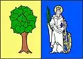 Flag 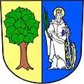 Coat of arms | |
 Šebrov-Kateřina Location in the Czech Republic | |
| Coordinates: 49°20′25″N 16°33′11″E / 49.34028°N 16.55306°E | |
| Country | |
| Region | South Moravian |
| District | Blansko |
| First mentioned | 1378 |
| Area | |
• Total | 10.29 km2 (3.97 sq mi) |
| Elevation | 338 m (1,109 ft) |
| Population (2025-01-01)[1] | |
• Total | 845 |
| • Density | 82/km2 (210/sq mi) |
| Time zone | UTC+1 (CET) |
| • Summer (DST) | UTC+2 (CEST) |
| Postal code | 679 22 |
| Website | www |
Šebrov-Kateřina is a municipality in Blansko District in the South Moravian Region of the Czech Republic. It has about 800 inhabitants.
Šebrov-Kateřina lies approximately 5 kilometres (3 mi) south-west of Blansko, 15 km (9 mi) north of Brno, and 179 km (111 mi) south-east of Prague.
Administrative division
Šebrov-Kateřina consists of two municipal parts (in brackets population according to the 2021 census):[2]
- Šebrov (615)
- Svatá Kateřina (207)
Demographics
| Year | Pop. | ±% |
|---|---|---|
| 1869 | 656 | — |
| 1880 | 770 | +17.4% |
| 1890 | 799 | +3.8% |
| 1900 | 874 | +9.4% |
| 1910 | 906 | +3.7% |
| 1921 | 967 | +6.7% |
| 1930 | 999 | +3.3% |
| 1950 | 877 | −12.2% |
| 1961 | 822 | −6.3% |
| 1970 | 793 | −3.5% |
| 1980 | 708 | −10.7% |
| 1991 | 591 | −16.5% |
| 2001 | 620 | +4.9% |
| 2011 | 772 | +24.5% |
| 2021 | 822 | +6.5% |
| Source: Censuses[3][4] | ||
References
- ^ "Population of Municipalities – 1 January 2025". Czech Statistical Office. 2025-05-16.
- ^ "Public Census 2021 – basic data". Public Database (in Czech). Czech Statistical Office. 2022.
- ^ "Historický lexikon obcí České republiky 1869–2011" (in Czech). Czech Statistical Office. 2015-12-21.
- ^ "Population Census 2021: Population by sex". Public Database. Czech Statistical Office. 2021-03-27.
External links
Wikimedia Commons has media related to Šebrov-Kateřina.