Žarošice
Žarošice | |
|---|---|
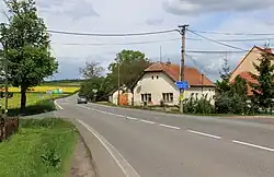 Silničná, a part of Žarošice | |
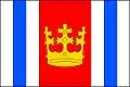 Flag 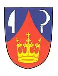 Coat of arms | |
 Žarošice Location in the Czech Republic | |
| Coordinates: 49°2′26″N 16°58′2″E / 49.04056°N 16.96722°E | |
| Country | |
| Region | South Moravian |
| District | Hodonín |
| First mentioned | 1322 |
| Area | |
• Total | 14.67 km2 (5.66 sq mi) |
| Elevation | 212 m (696 ft) |
| Population (2025-01-01)[1] | |
• Total | 1,117 |
| • Density | 76/km2 (200/sq mi) |
| Time zone | UTC+1 (CET) |
| • Summer (DST) | UTC+2 (CEST) |
| Postal code | 696 34 |
| Website | www |
Žarošice (German: Scharoschitz) is a municipality and village in Hodonín District in the South Moravian Region of the Czech Republic. It has about 1,100 inhabitants.
Žarošice lies approximately 26 kilometres (16 mi) north-west of Hodonín, 31 km (19 mi) south-east of Brno, and 218 km (135 mi) south-east of Prague.
Administrative division
Žarošice consists of three municipal parts (in brackets population according to the 2021 census):[2]
- Žarošice (993)
- Silničná (55)
- Zdravá Voda (27)
Demographics
| Year | Pop. | ±% |
|---|---|---|
| 1869 | 1,300 | — |
| 1880 | 1,453 | +11.8% |
| 1890 | 1,582 | +8.9% |
| 1900 | 1,559 | −1.5% |
| 1910 | 1,634 | +4.8% |
| 1921 | 1,587 | −2.9% |
| 1930 | 1,525 | −3.9% |
| 1950 | 1,378 | −9.6% |
| 1961 | 1,427 | +3.6% |
| 1970 | 1,274 | −10.7% |
| 1980 | 1,101 | −13.6% |
| 1991 | 1,009 | −8.4% |
| 2001 | 989 | −2.0% |
| 2011 | 1,020 | +3.1% |
| 2021 | 1,075 | +5.4% |
| Source: Censuses[3][4] | ||
References
- ^ "Population of Municipalities – 1 January 2025". Czech Statistical Office. 2025-05-16.
- ^ "Public Census 2021 – basic data". Public Database (in Czech). Czech Statistical Office. 2022.
- ^ "Historický lexikon obcí České republiky 1869–2011" (in Czech). Czech Statistical Office. 2015-12-21.
- ^ "Population Census 2021: Population by sex". Public Database. Czech Statistical Office. 2021-03-27.
External links
Wikimedia Commons has media related to Žarošice.