Karlín (Hodonín District)
Karlín | |
|---|---|
 Municipal office | |
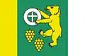 Flag 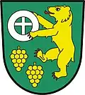 Coat of arms | |
 Karlín Location in the Czech Republic | |
| Coordinates: 48°58′33″N 16°58′38″E / 48.97583°N 16.97722°E | |
| Country | |
| Region | South Moravian |
| District | Hodonín |
| First mentioned | 1292 |
| Area | |
• Total | 2.24 km2 (0.86 sq mi) |
| Elevation | 195 m (640 ft) |
| Population (2025-01-01)[1] | |
• Total | 189 |
| • Density | 84/km2 (220/sq mi) |
| Time zone | UTC+1 (CET) |
| • Summer (DST) | UTC+2 (CEST) |
| Postal code | 696 14 |
| Website | www |
Karlín (German: Charlottenfeld) is a municipality and village in Hodonín District in the South Moravian Region of the Czech Republic. It has about 200 inhabitants.
Karlín lies approximately 18 kilometres (11 mi) north-west of Hodonín, 37 km (23 mi) south-east of Brno, and 223 km (139 mi) south-east of Prague.
Demographics
| Year | Pop. | ±% |
|---|---|---|
| 1869 | 215 | — |
| 1880 | 268 | +24.7% |
| 1890 | 219 | −18.3% |
| 1900 | 284 | +29.7% |
| 1910 | 419 | +47.5% |
| 1921 | 412 | −1.7% |
| 1930 | 443 | +7.5% |
| 1950 | 377 | −14.9% |
| 1961 | 384 | +1.9% |
| 1970 | 333 | −13.3% |
| 1980 | 283 | −15.0% |
| 1991 | 217 | −23.3% |
| 2001 | 209 | −3.7% |
| 2011 | 257 | +23.0% |
| 2021 | 197 | −23.3% |
| Source: Censuses[2][3] | ||
References
- ^ "Population of Municipalities – 1 January 2025". Czech Statistical Office. 2025-05-16.
- ^ "Historický lexikon obcí České republiky 1869–2011" (in Czech). Czech Statistical Office. 2015-12-21.
- ^ "Population Census 2021: Population by sex". Public Database. Czech Statistical Office. 2021-03-27.
External links
Wikimedia Commons has media related to Karlín (Hodonín District).