Terezín (Hodonín District)
Terezín | |
|---|---|
%252C_municipal_office.jpg) Municipal office | |
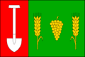 Flag 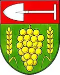 Coat of arms | |
 Terezín Location in the Czech Republic | |
| Coordinates: 48°57′20″N 16°56′33″E / 48.95556°N 16.94250°E | |
| Country | |
| Region | South Moravian |
| District | Hodonín |
| Founded | 1774 |
| Area | |
• Total | 3.74 km2 (1.44 sq mi) |
| Elevation | 184 m (604 ft) |
| Population (2025-01-01)[1] | |
• Total | 383 |
| • Density | 100/km2 (270/sq mi) |
| Time zone | UTC+1 (CET) |
| • Summer (DST) | UTC+2 (CEST) |
| Postal code | 696 14 |
| Website | www |
Terezín (German: Theresiendorf) is a municipality and village in Hodonín District in the South Moravian Region of the Czech Republic. It has about 400 inhabitants.
Terezín lies approximately 19 kilometres (12 mi) north-west of Hodonín, 36 km (22 mi) south-east of Brno, and 222 km (138 mi) south-east of Prague.
Demographics
| Year | Pop. | ±% |
|---|---|---|
| 1869 | 308 | — |
| 1880 | 339 | +10.1% |
| 1890 | 371 | +9.4% |
| 1900 | 433 | +16.7% |
| 1910 | 449 | +3.7% |
| 1921 | 472 | +5.1% |
| 1930 | 491 | +4.0% |
| 1950 | 436 | −11.2% |
| 1961 | 505 | +15.8% |
| 1970 | 486 | −3.8% |
| 1980 | 458 | −5.8% |
| 1991 | 377 | −17.7% |
| 2001 | 400 | +6.1% |
| 2011 | 399 | −0.2% |
| 2021 | 372 | −6.8% |
| Source: Censuses[2][3] | ||
References
- ^ "Population of Municipalities – 1 January 2025". Czech Statistical Office. 2025-05-16.
- ^ "Historický lexikon obcí České republiky 1869–2011" (in Czech). Czech Statistical Office. 2015-12-21.
- ^ "Population Census 2021: Population by sex". Public Database. Czech Statistical Office. 2021-03-27.
External links
Wikimedia Commons has media related to Terezín (Hodonín District).