Bukovany (Hodonín District)
Bukovany | |
|---|---|
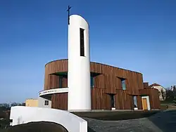 Chapel of Saint John Paul II | |
.GIF) Flag  Coat of arms | |
 Bukovany Location in the Czech Republic | |
| Coordinates: 49°2′32″N 17°6′3″E / 49.04222°N 17.10083°E | |
| Country | |
| Region | South Moravian |
| District | Hodonín |
| First mentioned | 1131 |
| Area | |
• Total | 3.29 km2 (1.27 sq mi) |
| Elevation | 304 m (997 ft) |
| Population (2025-01-01)[1] | |
• Total | 691 |
| • Density | 210/km2 (540/sq mi) |
| Time zone | UTC+1 (CET) |
| • Summer (DST) | UTC+2 (CEST) |
| Postal code | 696 31 |
| Website | www |
Bukovany is a municipality and village in Hodonín District in the South Moravian Region of the Czech Republic. It has about 700 inhabitants.
History
The first written mention of Bukovany is from 1131.[2]
Demographics
| Year | Pop. | ±% |
|---|---|---|
| 1869 | 581 | — |
| 1880 | 625 | +7.6% |
| 1890 | 610 | −2.4% |
| 1900 | 699 | +14.6% |
| 1910 | 729 | +4.3% |
| 1921 | 718 | −1.5% |
| 1930 | 784 | +9.2% |
| 1950 | 725 | −7.5% |
| 1961 | 893 | +23.2% |
| 1970 | 871 | −2.5% |
| 1980 | 829 | −4.8% |
| 1991 | 776 | −6.4% |
| 2001 | 769 | −0.9% |
| 2011 | 740 | −3.8% |
| 2021 | 665 | −10.1% |
| Source: Censuses[3][4] | ||
References
- ^ "Population of Municipalities – 1 January 2025". Czech Statistical Office. 2025-05-16.
- ^ "Historie" (in Czech). Obec Bukovany. Retrieved 2021-12-04.
- ^ "Historický lexikon obcí České republiky 1869–2011" (in Czech). Czech Statistical Office. 2015-12-21.
- ^ "Population Census 2021: Population by sex". Public Database. Czech Statistical Office. 2021-03-27.
External links
Wikimedia Commons has media related to Bukovany (Hodonín District).