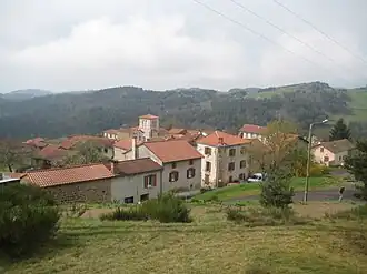
Agnat
Agnat | |
|---|---|
Commune | |
 | |
Location of Agnat | |
 Agnat  Agnat | |
| Coordinates: 45°20′39″N 3°26′58″E / 45.3442°N 3.4494°E | |
| Country | France |
| Region | Auvergne-Rhône-Alpes |
| Department | Haute-Loire |
| Arrondissement | Brioude |
| Canton | Sainte-Florine |
| Intercommunality | Brioude Sud Auvergne |
| Government | |
| • Mayor (2020–2026) | Christian Passemard[1] |
Area 1 | 19.65 km2 (7.59 sq mi) |
| Population (2022)[2] | 171 |
| • Density | 8.7/km2 (23/sq mi) |
| Time zone | UTC+01:00 (CET) |
| • Summer (DST) | UTC+02:00 (CEST) |
| INSEE/Postal code | 43001 /43100 |
| Elevation | 445–860 m (1,460–2,822 ft) (avg. 667 m or 2,188 ft) |
| 1 French Land Register data, which excludes lakes, ponds, glaciers > 1 km2 (0.386 sq mi or 247 acres) and river estuaries. | |
Agnat (French pronunciation: [aɡna]; Occitan: Anhac) is a commune in the Haute-Loire department and Auvergne-Rhône-Alpes region of south-east central France.
Population
| Year | Pop. | ±% p.a. |
|---|---|---|
| 1968 | 316 | — |
| 1975 | 302 | −0.65% |
| 1982 | 251 | −2.61% |
| 1990 | 222 | −1.52% |
| 1999 | 209 | −0.67% |
| 2007 | 189 | −1.25% |
| 2012 | 189 | +0.00% |
| 2017 | 187 | −0.21% |
| Source: INSEE[3] | ||
See also
References
- ^ "Répertoire national des élus: les maires". data.gouv.fr, Plateforme ouverte des données publiques françaises (in French). 2 December 2020.
- ^ "Populations de référence 2022" (in French). The National Institute of Statistics and Economic Studies. 19 December 2024.
- ^ Population en historique depuis 1968, INSEE
Wikimedia Commons has media related to Agnat.