Albersdorf, Thuringia
Albersdorf | |
|---|---|
Location of Albersdorf within Saale-Holzland-Kreis district 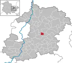 | |
 Albersdorf  Albersdorf | |
| Coordinates: 50°54′11″N 11°46′28″E / 50.90306°N 11.77444°E | |
| Country | Germany |
| State | Thuringia |
| District | Saale-Holzland-Kreis |
| Municipal assoc. | Bad Klosterlausnitz |
| Government | |
| • Mayor (2022–28) | Torsten Döhler[1] |
| Area | |
• Total | 2.85 km2 (1.10 sq mi) |
| Elevation | 355 m (1,165 ft) |
| Population (2024-12-31)[2] | |
• Total | 298 |
| • Density | 100/km2 (270/sq mi) |
| Time zone | UTC+01:00 (CET) |
| • Summer (DST) | UTC+02:00 (CEST) |
| Postal codes | 07646 |
| Dialling codes | 036692 |
| Vehicle registration | SHK, EIS, SRO |
| Website | www.bad-klosterlausnitz.de |
Albersdorf is a municipality in the Saale-Holzland district of Thuringia, Germany. As of 2018, the population is 288.[3]
Aluerdesdorpe was the original name of the area used when it was first mentioned in 1281, the name meaning 'village of the old custodian'.[4]
Geography
The town Albersdorf is about 15 kilometres (9.3 mi) east of the city centre of Jena and lies in the middle of Thuringian Holzland.[5]
References
- ^ Gewählte Bürgermeister - aktuelle Landesübersicht, Freistaat Thüringen, accessed 10 November 2022.
- ^ "Bevölkerung der Gemeinden vom Thüringer Landesamt für Statistik" (in German). Thüringer Landesamt für Statistik.
- ^ "Albersdorf (Saale-Holzland-Kreis, Thuringia, Germany) - Population Statistics, Charts, Map, Location, Weather and Web Information". www.citypopulation.de. Retrieved 2024-12-24.
- ^ "Mapy.cz". Mapy.cz. Retrieved 2024-12-24.
- ^ "Albersdorf - Municipality". RouteYou. Retrieved 2024-12-24.