Baupte
Baupte | |
|---|---|
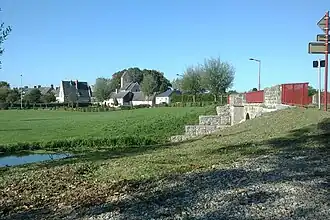 Baupte from the bridge over the Sèves | |
Location of Baupte | |
 Baupte  Baupte | |
| Coordinates: 49°18′32″N 1°21′36″W / 49.3089°N 1.36°W | |
| Country | France |
| Region | Normandy |
| Department | Manche |
| Arrondissement | Coutances |
| Canton | Carentan-les-Marais |
| Intercommunality | Baie du Cotentin |
| Government | |
| • Mayor (2020–2026) | Daniel Thomas[1] |
Area 1 | 2.29 km2 (0.88 sq mi) |
| Population (2022)[2] | 428 |
| • Density | 190/km2 (480/sq mi) |
| Time zone | UTC+01:00 (CET) |
| • Summer (DST) | UTC+02:00 (CEST) |
| INSEE/Postal code | 50036 /50500 |
| Elevation | 2–26 m (6.6–85.3 ft) (avg. 20 m or 66 ft) |
| 1 French Land Register data, which excludes lakes, ponds, glaciers > 1 km2 (0.386 sq mi or 247 acres) and river estuaries. | |
Baupte (French pronunciation: [bot]) is a commune in the northwestern French department of Manche, a part of Normandy.
Population
| Year | Pop. | ±% p.a. |
|---|---|---|
| 1968 | 422 | — |
| 1975 | 501 | +2.48% |
| 1982 | 520 | +0.53% |
| 1990 | 431 | −2.32% |
| 1999 | 422 | −0.23% |
| 2009 | 454 | +0.73% |
| 2014 | 435 | −0.85% |
| 2020 | 439 | +0.15% |
| Source: INSEE[3] | ||
See also
References
- ^ "Répertoire national des élus: les maires". data.gouv.fr, Plateforme ouverte des données publiques françaises (in French). 2 December 2020.
- ^ "Populations de référence 2022" (in French). The National Institute of Statistics and Economic Studies. 19 December 2024.
- ^ Population en historique depuis 1968, INSEE
Wikimedia Commons has media related to Baupte.