Brambory
Brambory | |
|---|---|
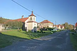 Chapel in Brambory | |
 Brambory Location in the Czech Republic | |
| Coordinates: 49°58′42″N 15°28′13″E / 49.97833°N 15.47028°E | |
| Country | |
| Region | Central Bohemian |
| District | Kutná Hora |
| First mentioned | 1393 |
| Area | |
• Total | 1.25 km2 (0.48 sq mi) |
| Elevation | 234 m (768 ft) |
| Population (2025-01-01)[1] | |
• Total | 112 |
| • Density | 90/km2 (230/sq mi) |
| Time zone | UTC+1 (CET) |
| • Summer (DST) | UTC+2 (CEST) |
| Postal code | 286 01 |
| Website | www |
Brambory is a municipality and village in Kutná Hora District in the Central Bohemian Region of the Czech Republic. It has about 100 inhabitants.
Demographics
| Year | Pop. | ±% |
|---|---|---|
| 1869 | 107 | — |
| 1880 | 113 | +5.6% |
| 1890 | 176 | +55.8% |
| 1900 | 172 | −2.3% |
| 1910 | 199 | +15.7% |
| 1921 | 126 | −36.7% |
| 1930 | 192 | +52.4% |
| 1950 | 92 | −52.1% |
| 1961 | 91 | −1.1% |
| 1970 | 167 | +83.5% |
| 1980 | 137 | −18.0% |
| 1991 | 108 | −21.2% |
| 2001 | 104 | −3.7% |
| 2011 | 111 | +6.7% |
| 2021 | 125 | +12.6% |
| Source: Censuses[2][3] | ||
References
- ^ "Population of Municipalities – 1 January 2025". Czech Statistical Office. 2025-05-16.
- ^ "Historický lexikon obcí České republiky 1869–2011" (in Czech). Czech Statistical Office. 2015-12-21.
- ^ "Population Census 2021: Population by sex". Public Database. Czech Statistical Office. 2021-03-27.
External links
Wikimedia Commons has media related to Brambory.