Chérac
Chérac | |
|---|---|
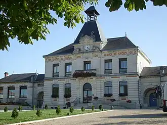 Town hall | |
 Coat of arms | |
Location of Chérac | |
 Chérac  Chérac | |
| Coordinates: 45°42′15″N 0°26′11″W / 45.7042°N 0.4364°W | |
| Country | France |
| Region | Nouvelle-Aquitaine |
| Department | Charente-Maritime |
| Arrondissement | Saintes |
| Canton | Chaniers |
| Intercommunality | CA Saintes |
| Government | |
| • Mayor (2023–2026) | Anne-Sophie Serra-Davisseau[1] |
Area 1 | 29.88 km2 (11.54 sq mi) |
| Population (2022)[2] | 1,135 |
| • Density | 38/km2 (98/sq mi) |
| Time zone | UTC+01:00 (CET) |
| • Summer (DST) | UTC+02:00 (CEST) |
| INSEE/Postal code | 17100 /17610 |
| Elevation | 2–95 m (6.6–311.7 ft) |
| 1 French Land Register data, which excludes lakes, ponds, glaciers > 1 km2 (0.386 sq mi or 247 acres) and river estuaries. | |
Chérac[3] (French pronunciation: [ʃeʁak]) is a commune in the Charente-Maritime department in southwestern France.
Population
| Year | Pop. | ±% p.a. |
|---|---|---|
| 1968 | 879 | — |
| 1975 | 813 | −1.11% |
| 1982 | 946 | +2.19% |
| 1990 | 1,045 | +1.25% |
| 1999 | 1,006 | −0.42% |
| 2009 | 1,078 | +0.69% |
| 2014 | 1,098 | +0.37% |
| 2020 | 1,125 | +0.41% |
| Source: INSEE[4] | ||
See also
References
- ^ "Répertoire national des élus: les maires" (in French). data.gouv.fr, Plateforme ouverte des données publiques françaises. 6 June 2023.
- ^ "Populations de référence 2022" (in French). The National Institute of Statistics and Economic Studies. 19 December 2024.
- ^ Commune de Chérac, Commune de Chérac, retrieved 6 March 2024
- ^ Population en historique depuis 1968, INSEE
External links
 Media related to Chérac at Wikimedia Commons