La Vergne, Charente-Maritime
La Vergne | |
|---|---|
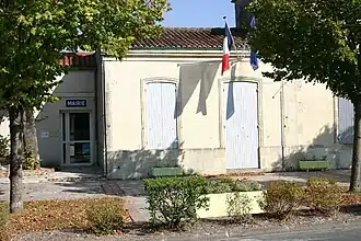 The town hall in La Vergne | |
.svg.png) Coat of arms | |
Location of La Vergne | |
 La Vergne  La Vergne | |
| Coordinates: 45°57′47″N 0°33′48″W / 45.9631°N 0.5633°W | |
| Country | France |
| Region | Nouvelle-Aquitaine |
| Department | Charente-Maritime |
| Arrondissement | Saint-Jean-d'Angély |
| Canton | Saint-Jean-d'Angély |
| Intercommunality | Vals de Saintonge |
| Government | |
| • Mayor (2020–2026) | Alain Ingrand[1] |
Area 1 | 13.97 km2 (5.39 sq mi) |
| Population (2022)[2] | 610 |
| • Density | 44/km2 (110/sq mi) |
| Demonym(s) | Vergnaud, Vergnaude |
| Time zone | UTC+01:00 (CET) |
| • Summer (DST) | UTC+02:00 (CEST) |
| INSEE/Postal code | 17465 /17400 |
| Elevation | 5–74 m (16–243 ft) (avg. 12 m or 39 ft) |
| 1 French Land Register data, which excludes lakes, ponds, glaciers > 1 km2 (0.386 sq mi or 247 acres) and river estuaries. | |
La Vergne (French pronunciation: [la vɛʁɲ]) is a commune in the department of Charente-Maritime in the region of Nouvelle-Aquitaine, southwestern France.
Population
| Year | Pop. | ±% |
|---|---|---|
| 1962 | 534 | — |
| 1968 | 548 | +2.6% |
| 1975 | 526 | −4.0% |
| 1982 | 479 | −8.9% |
| 1990 | 591 | +23.4% |
| 1999 | 569 | −3.7% |
| 2008 | 674 | +18.5% |
Geography
The river Boutonne forms all of the commune's southern border.
See also
References
- ^ "Répertoire national des élus: les maires". data.gouv.fr, Plateforme ouverte des données publiques françaises (in French). 9 August 2021.
- ^ "Populations de référence 2022" (in French). The National Institute of Statistics and Economic Studies. 19 December 2024.
External links
 Media related to La Vergne (Charente-Maritime) at Wikimedia Commons