Crésantignes
Crésantignes | |
|---|---|
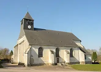 The church in Crésantignes | |
 Coat of arms | |
Location of Crésantignes | |
 Crésantignes  Crésantignes | |
| Coordinates: 48°08′30″N 4°01′12″E / 48.1417°N 4.02°E | |
| Country | France |
| Region | Grand Est |
| Department | Aube |
| Arrondissement | Troyes |
| Canton | Les Riceys |
| Intercommunality | CA Troyes Champagne Métropole |
| Government | |
| • Mayor (2020–2026) | Dominique Blanchard[1] |
Area 1 | 2.1 km2 (0.8 sq mi) |
| Population (2022)[2] | 310 |
| • Density | 150/km2 (380/sq mi) |
| Time zone | UTC+01:00 (CET) |
| • Summer (DST) | UTC+02:00 (CEST) |
| INSEE/Postal code | 10116 /10320 |
| Elevation | 184 m (604 ft) |
| 1 French Land Register data, which excludes lakes, ponds, glaciers > 1 km2 (0.386 sq mi or 247 acres) and river estuaries. | |
Crésantignes (French pronunciation: [kʁezɑ̃tiɲ]) is a commune in the Aube department in north-central France.
Population
| Year | Pop. | ±% |
|---|---|---|
| 1962 | 168 | — |
| 1968 | 208 | +23.8% |
| 1975 | 202 | −2.9% |
| 1982 | 256 | +26.7% |
| 1990 | 277 | +8.2% |
| 1999 | 269 | −2.9% |
| 2008 | 273 | +1.5% |
See also
References
- ^ "Répertoire national des élus: les maires" (in French). data.gouv.fr, Plateforme ouverte des données publiques françaises. 13 September 2022.
- ^ "Populations de référence 2022" (in French). The National Institute of Statistics and Economic Studies. 19 December 2024.
Wikimedia Commons has media related to Crésantignes.