Curtil-sous-Burnand
Curtil-sous-Burnand | |
|---|---|
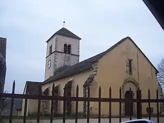 The church in Curtil-sous-Burnand | |
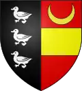 Coat of arms | |
Location of Curtil-sous-Burnand | |
 Curtil-sous-Burnand  Curtil-sous-Burnand | |
| Coordinates: 46°34′59″N 4°38′03″E / 46.5831°N 4.6342°E | |
| Country | France |
| Region | Bourgogne-Franche-Comté |
| Department | Saône-et-Loire |
| Arrondissement | Chalon-sur-Saône |
| Canton | Cluny |
Area 1 | 8.34 km2 (3.22 sq mi) |
| Population (2022)[1] | 139 |
| • Density | 17/km2 (43/sq mi) |
| Time zone | UTC+01:00 (CET) |
| • Summer (DST) | UTC+02:00 (CEST) |
| INSEE/Postal code | 71164 /71460 |
| Elevation | 209–402 m (686–1,319 ft) (avg. 260 m or 850 ft) |
| 1 French Land Register data, which excludes lakes, ponds, glaciers > 1 km2 (0.386 sq mi or 247 acres) and river estuaries. | |
Curtil-sous-Burnand is a commune in the Saône-et-Loire department in the region of Bourgogne-Franche-Comté in eastern France.
See also
References
- ^ "Populations de référence 2022" (in French). The National Institute of Statistics and Economic Studies. 19 December 2024.
Wikimedia Commons has media related to Curtil-sous-Burnand.