Hary
Hary | |
|---|---|
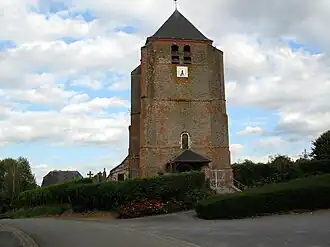 The church of Hary | |
Location of Hary | |
 Hary  Hary | |
| Coordinates: 49°47′20″N 3°56′02″E / 49.7889°N 3.9339°E | |
| Country | France |
| Region | Hauts-de-France |
| Department | Aisne |
| Arrondissement | Vervins |
| Canton | Vervins |
| Intercommunality | Thiérache du Centre |
| Government | |
| • Mayor (2020–2026) | Céline Cus[1] |
Area 1 | 11.04 km2 (4.26 sq mi) |
| Population (2022)[2] | 196 |
| • Density | 18/km2 (46/sq mi) |
| Time zone | UTC+01:00 (CET) |
| • Summer (DST) | UTC+02:00 (CEST) |
| INSEE/Postal code | 02373 /02140 |
| Elevation | 106–192 m (348–630 ft) (avg. 114 m or 374 ft) |
| 1 French Land Register data, which excludes lakes, ponds, glaciers > 1 km2 (0.386 sq mi or 247 acres) and river estuaries. | |
Hary (French pronunciation: [aʁi]) is a commune in the Aisne department in Hauts-de-France in northern France.
Population
| Year | Pop. | ±% p.a. |
|---|---|---|
| 1968 | 270 | — |
| 1975 | 220 | −2.88% |
| 1982 | 214 | −0.39% |
| 1990 | 221 | +0.40% |
| 1999 | 232 | +0.54% |
| 2009 | 223 | −0.39% |
| 2014 | 225 | +0.18% |
| 2020 | 193 | −2.52% |
| Source: INSEE[3] | ||
See also
References
- ^ "Répertoire national des élus: les maires". data.gouv.fr, Plateforme ouverte des données publiques françaises (in French). 2 December 2020.
- ^ "Populations de référence 2022" (in French). The National Institute of Statistics and Economic Studies. 19 December 2024.
- ^ Population en historique depuis 1968, INSEE
Wikimedia Commons has media related to Hary.