Jedlany
Jedlany | |
|---|---|
 Main road | |
 Flag  Coat of arms | |
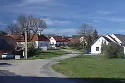
 Jedlany Location in the Czech Republic | |
| Coordinates: 49°29′41″N 14°42′59″E / 49.49472°N 14.71639°E | |
| Country | |
| Region | South Bohemian |
| District | Tábor |
| First mentioned | 1369 |
| Area | |
• Total | 4.21 km2 (1.63 sq mi) |
| Elevation | 486 m (1,594 ft) |
| Population (2025-01-01)[1] | |
• Total | 75 |
| • Density | 18/km2 (46/sq mi) |
| Time zone | UTC+1 (CET) |
| • Summer (DST) | UTC+2 (CEST) |
| Postal code | 391 37 |
| Website | www |
Jedlany is a municipality and village in Tábor District in the South Bohemian Region of the Czech Republic. It has about 80 inhabitants.
Jedlany lies approximately 10 kilometres (6 mi) north-east of Tábor, 60 km (37 mi) north of České Budějovice, and 70 km (43 mi) south of Prague.
Demographics
| Year | Pop. | ±% |
|---|---|---|
| 1869 | 316 | — |
| 1880 | 341 | +7.9% |
| 1890 | 391 | +14.7% |
| 1900 | 318 | −18.7% |
| 1910 | 281 | −11.6% |
| 1921 | 271 | −3.6% |
| 1930 | 225 | −17.0% |
| 1950 | 175 | −22.2% |
| 1961 | 178 | +1.7% |
| 1970 | 153 | −14.0% |
| 1980 | 110 | −28.1% |
| 1991 | 77 | −30.0% |
| 2001 | 68 | −11.7% |
| 2011 | 70 | +2.9% |
| 2021 | 79 | +12.9% |
| Source: Censuses[2][3] | ||
References
- ^ "Population of Municipalities – 1 January 2025". Czech Statistical Office. 2025-05-16.
- ^ "Historický lexikon obcí České republiky 1869–2011" (in Czech). Czech Statistical Office. 2015-12-21.
- ^ "Population Census 2021: Population by sex". Public Database. Czech Statistical Office. 2021-03-27.
External links
Wikimedia Commons has media related to Jedlany.