Krtov
Krtov | |
|---|---|
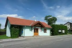 Municipal office | |
 Krtov Location in the Czech Republic | |
| Coordinates: 49°20′55″N 14°49′57″E / 49.34861°N 14.83250°E | |
| Country | |
| Region | South Bohemian |
| District | Tábor |
| First mentioned | 1379 |
| Area | |
• Total | 4.56 km2 (1.76 sq mi) |
| Elevation | 558 m (1,831 ft) |
| Population (2025-01-01)[1] | |
• Total | 164 |
| • Density | 36/km2 (93/sq mi) |
| Time zone | UTC+1 (CET) |
| • Summer (DST) | UTC+2 (CEST) |
| Postal code | 392 01 |
| Website | www |
Krtov is a municipality and village in Tábor District in the South Bohemian Region of the Czech Republic. It has about 200 inhabitants.
Krtov lies approximately 15 kilometres (9 mi) south-east of Tábor, 49 km (30 mi) north-east of České Budějovice, and 88 km (55 mi) south of Prague.
Demographics
| Year | Pop. | ±% |
|---|---|---|
| 1869 | 286 | — |
| 1880 | 285 | −0.3% |
| 1890 | 275 | −3.5% |
| 1900 | 254 | −7.6% |
| 1910 | 268 | +5.5% |
| 1921 | 268 | +0.0% |
| 1930 | 234 | −12.7% |
| 1950 | 165 | −29.5% |
| 1961 | 170 | +3.0% |
| 1970 | 162 | −4.7% |
| 1980 | 161 | −0.6% |
| 1991 | 128 | −20.5% |
| 2001 | 141 | +10.2% |
| 2011 | 142 | +0.7% |
| 2021 | 160 | +12.7% |
| Source: Censuses[2][3] | ||
References
- ^ "Population of Municipalities – 1 January 2025". Czech Statistical Office. 2025-05-16.
- ^ "Historický lexikon obcí České republiky 1869–2011" (in Czech). Czech Statistical Office. 2015-12-21.
- ^ "Population Census 2021: Population by sex". Public Database. Czech Statistical Office. 2021-03-27.
External links
Wikimedia Commons has media related to Krtov.