Kostelany nad Moravou
Kostelany nad Moravou | |
|---|---|
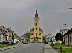 Centre with Church of Saint Florian | |
 Flag 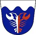 Coat of arms | |
 Kostelany nad Moravou Location in the Czech Republic | |
| Coordinates: 49°2′43″N 17°24′25″E / 49.04528°N 17.40694°E | |
| Country | |
| Region | Zlín |
| District | Uherské Hradiště |
| First mentioned | 1131 |
| Area | |
• Total | 4.76 km2 (1.84 sq mi) |
| Elevation | 177 m (581 ft) |
| Population (2025-01-01)[1] | |
• Total | 889 |
| • Density | 190/km2 (480/sq mi) |
| Time zone | UTC+1 (CET) |
| • Summer (DST) | UTC+2 (CEST) |
| Postal code | 686 01 |
| Website | www |
Kostelany nad Moravou is a municipality and village in Uherské Hradiště District in the Zlín Region of the Czech Republic. It has about 900 inhabitants.
Kostelany nad Moravou lies approximately 5 kilometres (3 mi) south-west of Uherské Hradiště, 29 km (18 mi) south-west of Zlín, and 245 km (152 mi) south-east of Prague.
Demographics
| Year | Pop. | ±% |
|---|---|---|
| 1869 | 635 | — |
| 1880 | 702 | +10.6% |
| 1890 | 758 | +8.0% |
| 1900 | 817 | +7.8% |
| 1910 | 865 | +5.9% |
| 1921 | 932 | +7.7% |
| 1930 | 895 | −4.0% |
| 1950 | 919 | +2.7% |
| 1961 | 1,035 | +12.6% |
| 1970 | 1,042 | +0.7% |
| 1980 | 968 | −7.1% |
| 1991 | 906 | −6.4% |
| 2001 | 888 | −2.0% |
| 2011 | 887 | −0.1% |
| 2021 | 843 | −5.0% |
| Source: Censuses[2][3] | ||
References
- ^ "Population of Municipalities – 1 January 2025". Czech Statistical Office. 2025-05-16.
- ^ "Historický lexikon obcí České republiky 1869–2011" (in Czech). Czech Statistical Office. 2015-12-21.
- ^ "Population Census 2021: Population by sex". Public Database. Czech Statistical Office. 2021-03-27.
External links
Wikimedia Commons has media related to Kostelany nad Moravou.