Staré Hutě
Staré Hutě | |
|---|---|
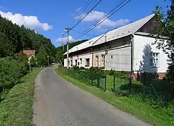 Main street | |
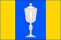 Flag 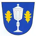 Coat of arms | |
 Staré Hutě Location in the Czech Republic | |
| Coordinates: 49°7′45″N 17°16′40″E / 49.12917°N 17.27778°E | |
| Country | |
| Region | Zlín |
| District | Uherské Hradiště |
| First mentioned | 1665 |
| Area | |
• Total | 7.34 km2 (2.83 sq mi) |
| Elevation | 393 m (1,289 ft) |
| Population (2025-01-01)[1] | |
• Total | 135 |
| • Density | 18/km2 (48/sq mi) |
| Time zone | UTC+1 (CET) |
| • Summer (DST) | UTC+2 (CEST) |
| Postal code | 686 01 |
| Website | www |
Staré Hutě (German: Althütten) is a municipality and village in Uherské Hradiště District in the Zlín Region of the Czech Republic. It has about 100 inhabitants.
Staré Hutě lies approximately 16 kilometres (10 mi) north-west of Uherské Hradiště, 31 km (19 mi) west of Zlín, and 232 km (144 mi) south-east of Prague. The Kyjovka River originates in the municipal territory.
Demographics
| Year | Pop. | ±% |
|---|---|---|
| 1869 | 390 | — |
| 1880 | 333 | −14.6% |
| 1890 | 320 | −3.9% |
| 1900 | 282 | −11.9% |
| 1910 | 280 | −0.7% |
| 1921 | 261 | −6.8% |
| 1930 | 249 | −4.6% |
| 1950 | 240 | −3.6% |
| 1961 | 233 | −2.9% |
| 1970 | 191 | −18.0% |
| 1980 | 169 | −11.5% |
| 1991 | 120 | −29.0% |
| 2001 | 124 | +3.3% |
| 2011 | 127 | +2.4% |
| 2021 | 126 | −0.8% |
| Source: Censuses[2][3] | ||
References
- ^ "Population of Municipalities – 1 January 2025". Czech Statistical Office. 2025-05-16.
- ^ "Historický lexikon obcí České republiky 1869–2011" (in Czech). Czech Statistical Office. 2015-12-21.
- ^ "Population Census 2021: Population by sex". Public Database. Czech Statistical Office. 2021-03-27.
External links
Wikimedia Commons has media related to Staré Hutě.