Kunemil
Kunemil | |
|---|---|
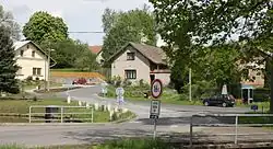 Centre of Kunemil | |
 Flag  Coat of arms | |
 Kunemil Location in the Czech Republic | |
| Coordinates: 49°42′27″N 15°25′54″E / 49.70750°N 15.43167°E | |
| Country | |
| Region | Vysočina |
| District | Havlíčkův Brod |
| First mentioned | 1310 |
| Area | |
• Total | 4.50 km2 (1.74 sq mi) |
| Elevation | 468 m (1,535 ft) |
| Population (2025-01-01)[1] | |
• Total | 113 |
| • Density | 25/km2 (65/sq mi) |
| Time zone | UTC+1 (CET) |
| • Summer (DST) | UTC+2 (CEST) |
| Postal code | 582 91 |
| Website | www |
Kunemil is a municipality and village in Havlíčkův Brod District in the Vysočina Region of the Czech Republic. It has about 100 inhabitants.
Kunemil lies approximately 16 kilometres (10 mi) north-west of Havlíčkův Brod, 37 km (23 mi) north of Jihlava, and 84 km (52 mi) south-east of Prague.
Demographics
| Year | Pop. | ±% |
|---|---|---|
| 1869 | 368 | — |
| 1880 | 440 | +19.6% |
| 1890 | 397 | −9.8% |
| 1900 | 423 | +6.5% |
| 1910 | 396 | −6.4% |
| 1921 | 364 | −8.1% |
| 1930 | 320 | −12.1% |
| 1950 | 235 | −26.6% |
| 1961 | 208 | −11.5% |
| 1970 | 182 | −12.5% |
| 1980 | 157 | −13.7% |
| 1991 | 112 | −28.7% |
| 2001 | 109 | −2.7% |
| 2011 | 109 | +0.0% |
| 2021 | 109 | +0.0% |
| Source: Censuses[2][3] | ||
References
- ^ "Population of Municipalities – 1 January 2025". Czech Statistical Office. 2025-05-16.
- ^ "Historický lexikon obcí České republiky 1869–2011" (in Czech). Czech Statistical Office. 2015-12-21.
- ^ "Population Census 2021: Population by sex". Public Database. Czech Statistical Office. 2021-03-27.
External links
Wikimedia Commons has media related to Kunemil.